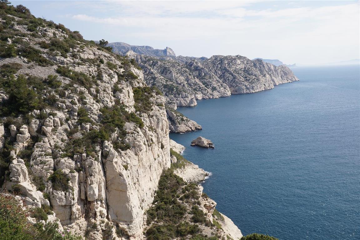
In south central France, everyone has heard of the “Calanques”, a zone of low but craggy white limestone peaks, arid valleys and narrow sea inlets between Marseille and Cassis. Calanque refers to a particular type of narrow inlet or cove – typically deeply indented into the coastline. In 2012 a national park was created here covering an area of land and sea. The Calanques area is frequented by many different users including divers, climbers, and hikers. For hikers, a waymarked trail runs more or less parallel to the coast all the way between Cassis and the southern end of Marseille. The trail is a stretch for a single day walk (22 km and about 2000 m cumulative climb) but easy to complete in 2 days so you usually need an overnight stay near one of the trail heads and an arrangement to be picked up at the chosen endpoint.
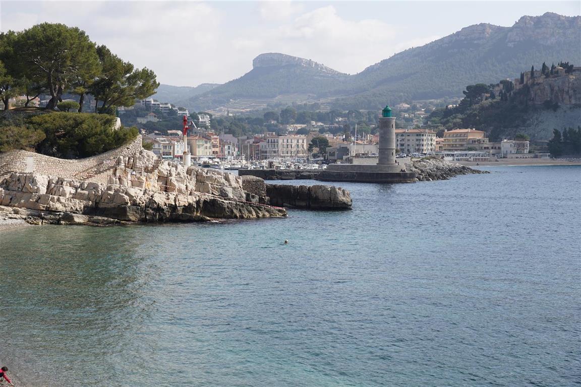
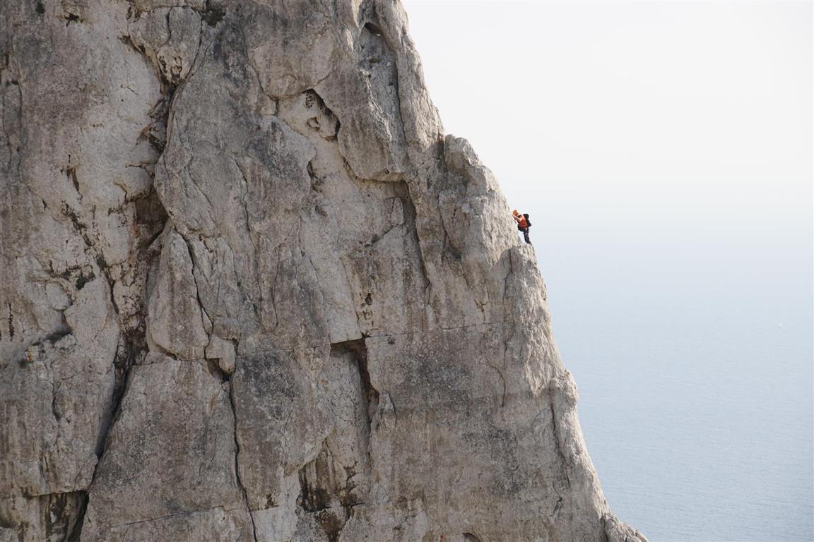
The main walking route, a GR (Grande Randonnée trail), is waymarked in red and white is in good shape. But there are many alternate routes with various types and forms of waymarking and some of these are in poor shape or, in some cases, require the use of climbing harnesses. So for a first trip we decide to stick to the GR and start from Cassis. We walk from Cassis to Luminy on day one and from Callelongue (south end of Marseille) to Luminy on day two.
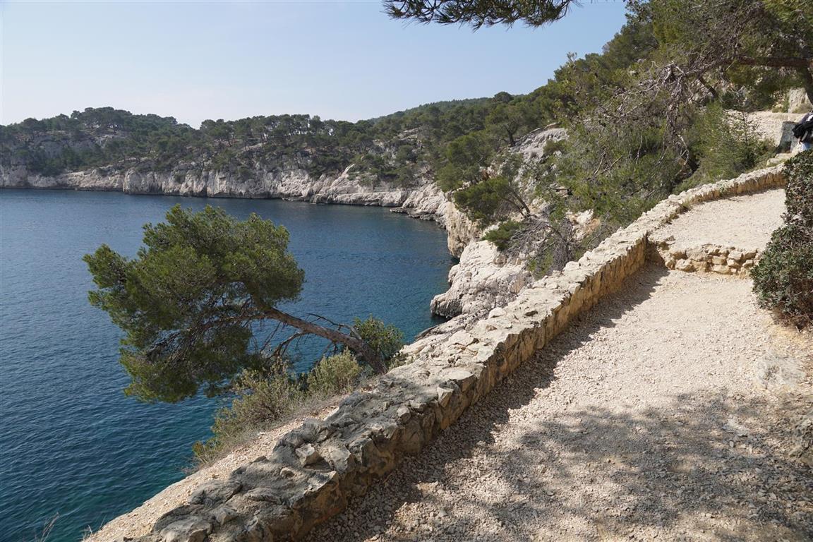
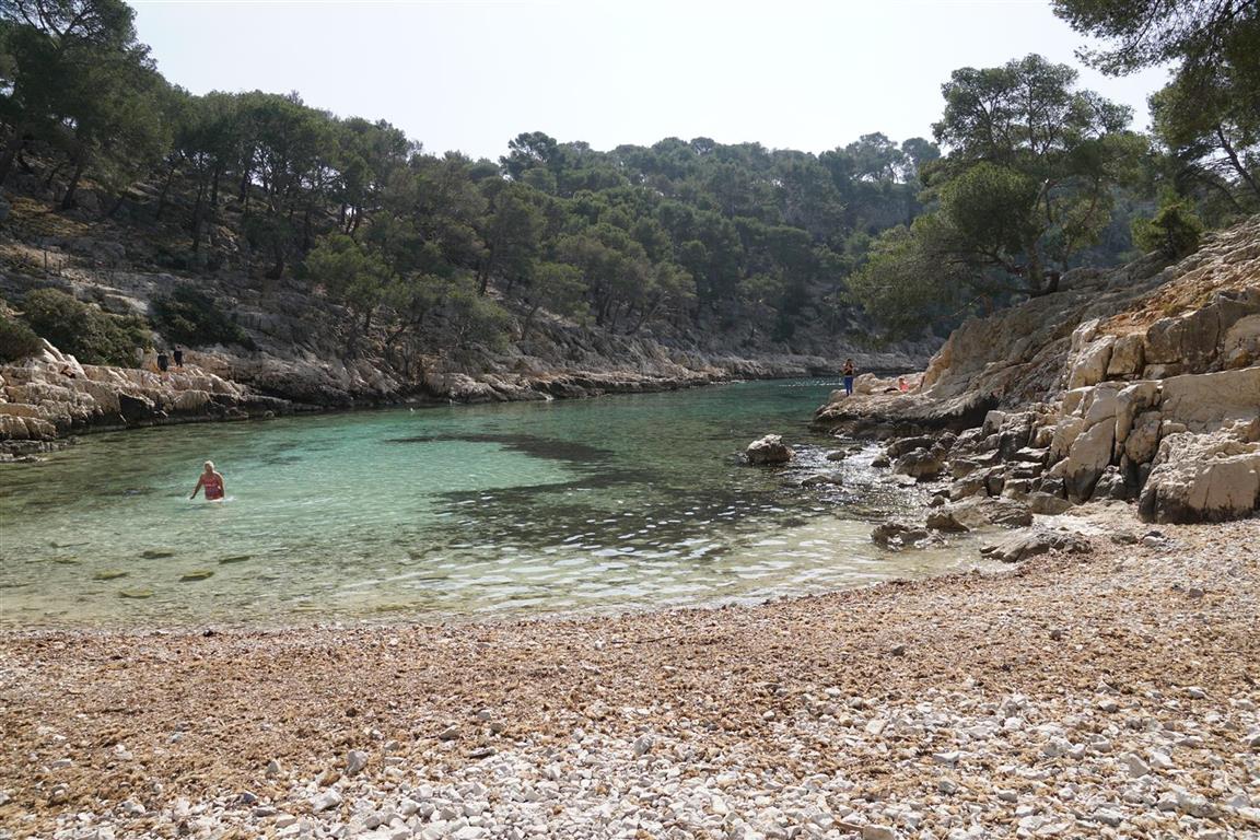

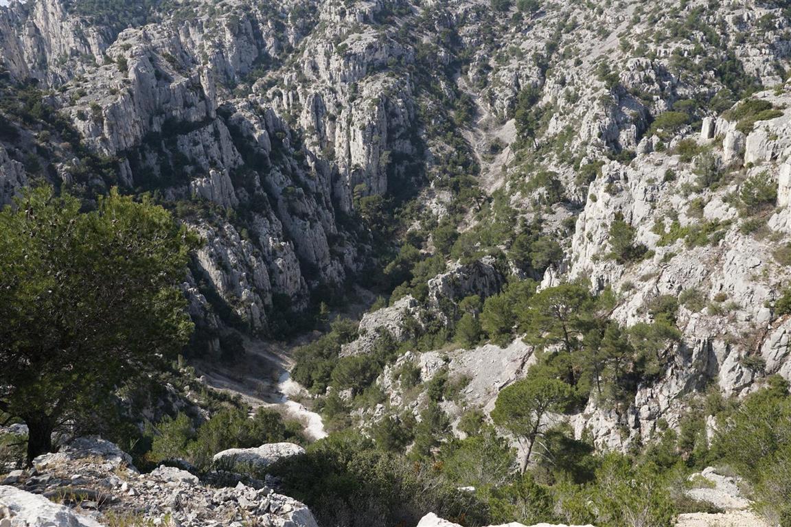
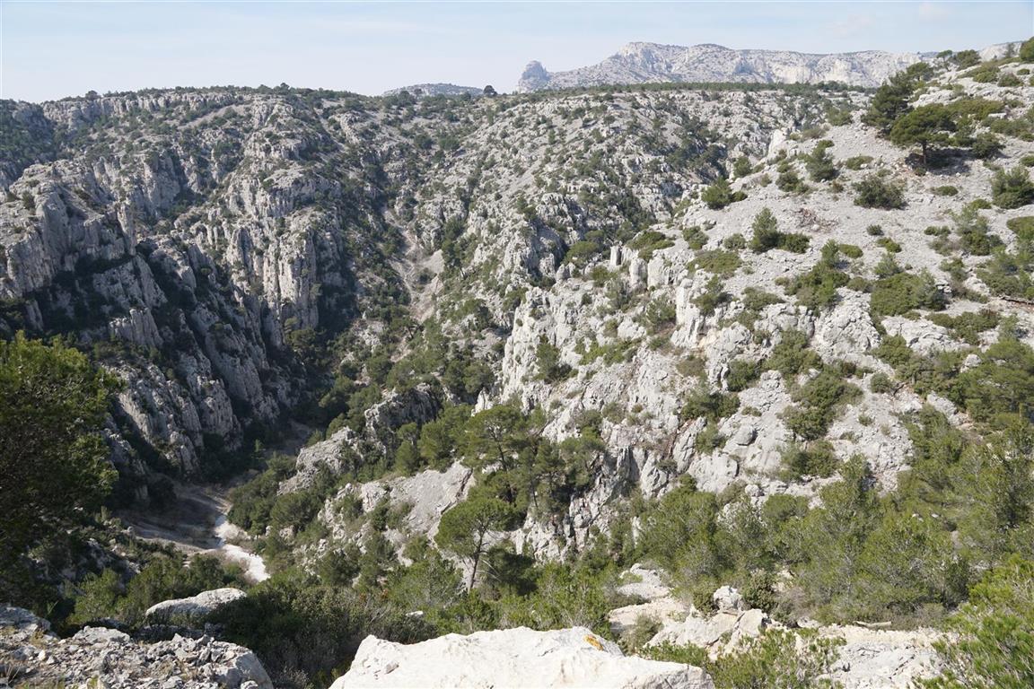

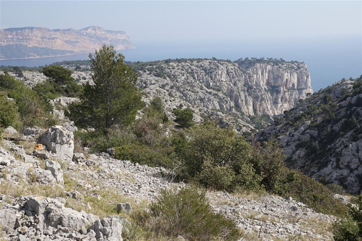
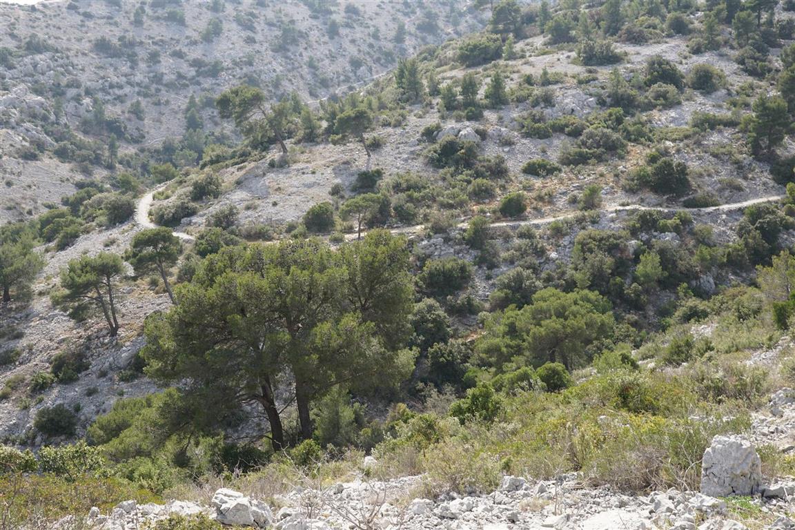
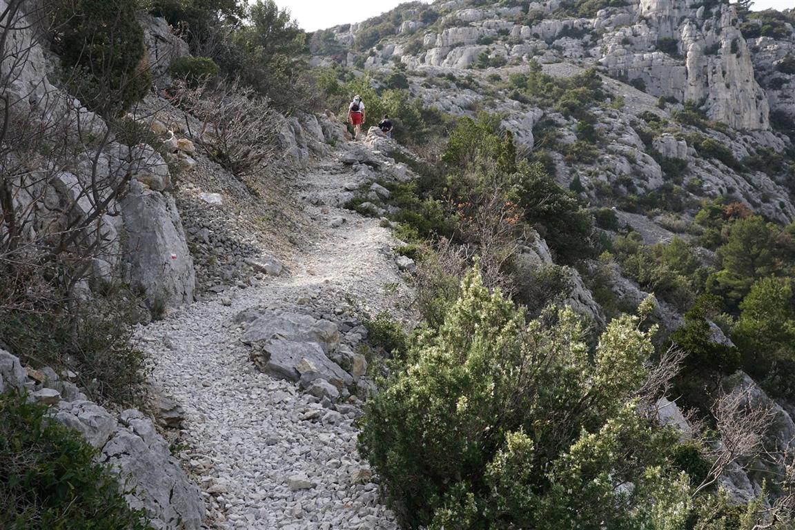
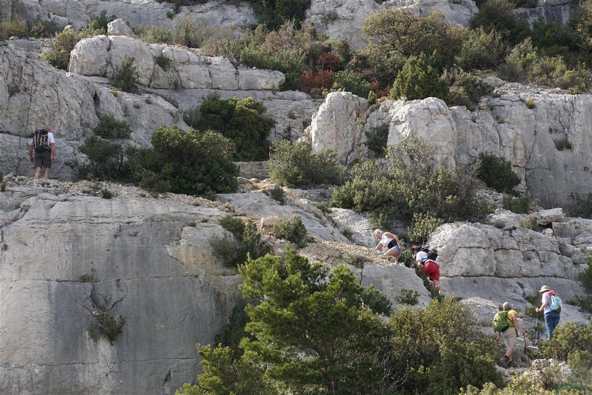
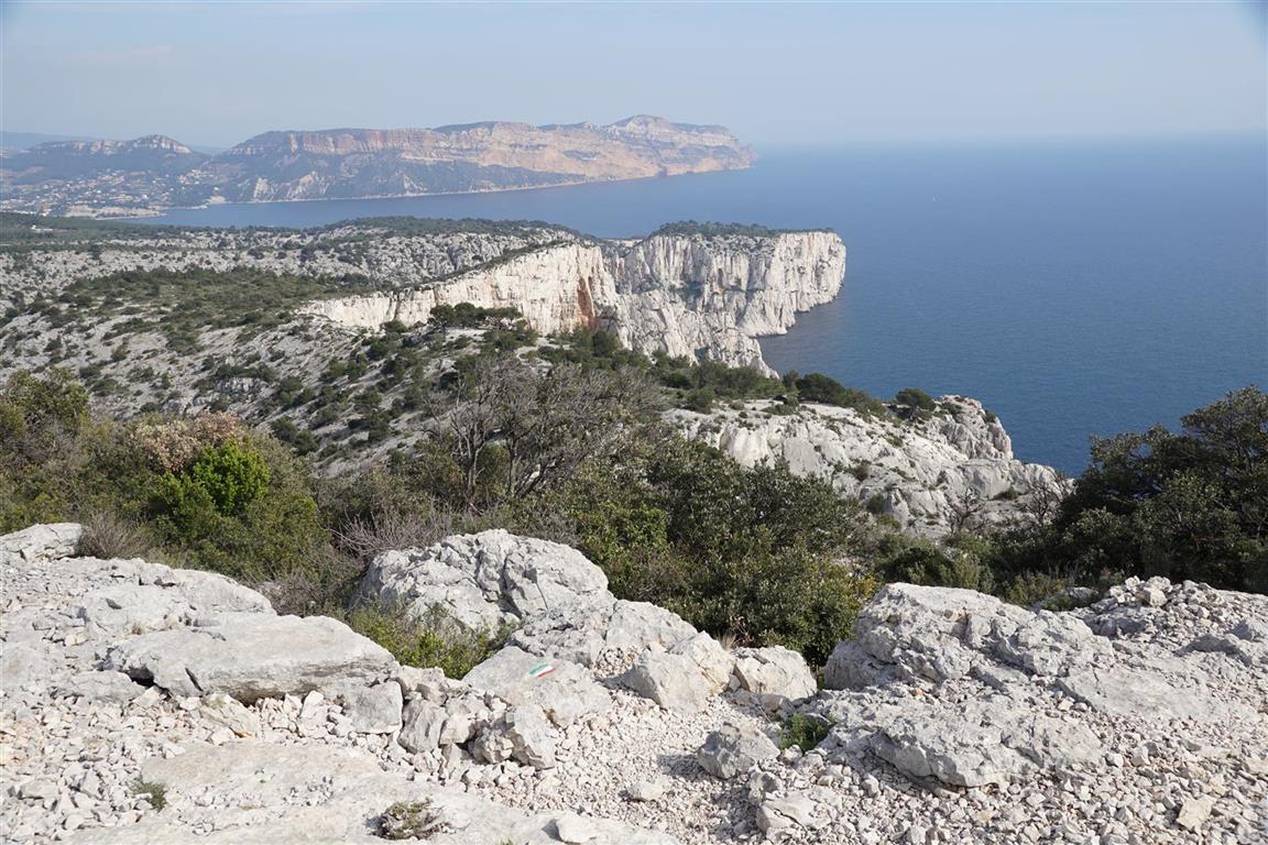
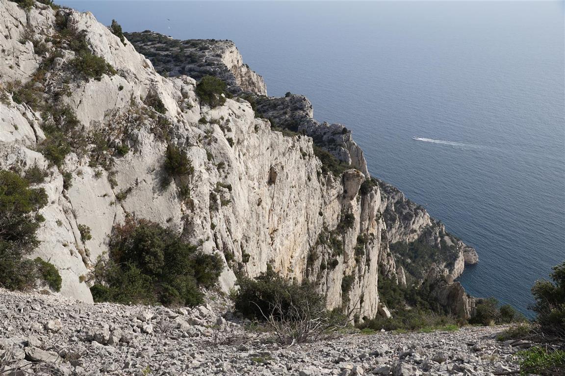
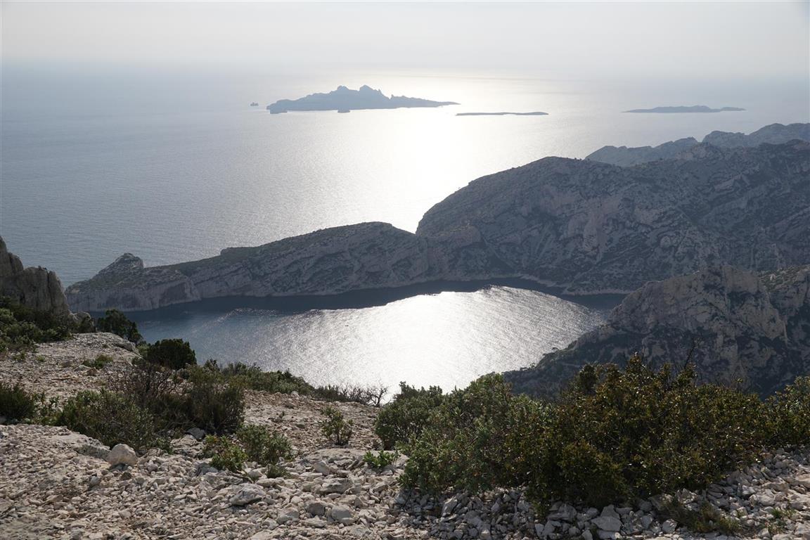
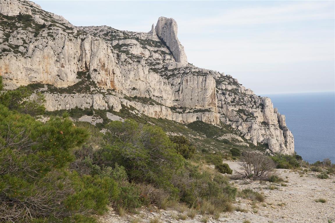


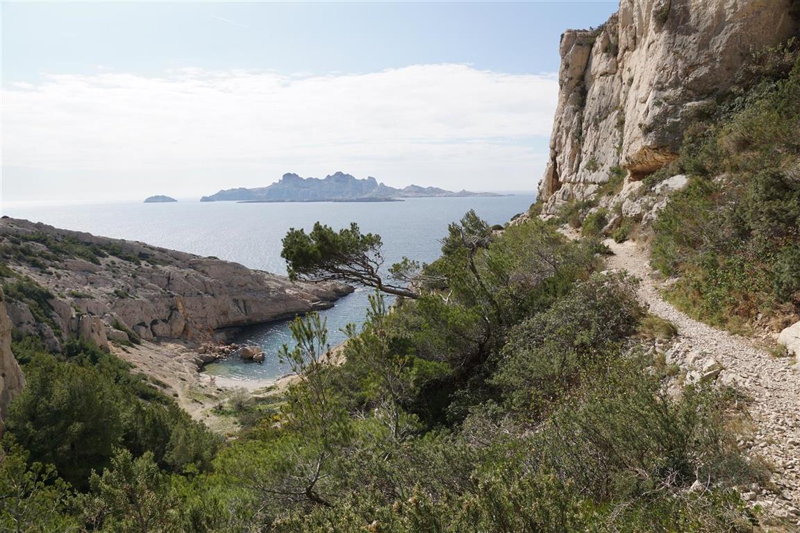

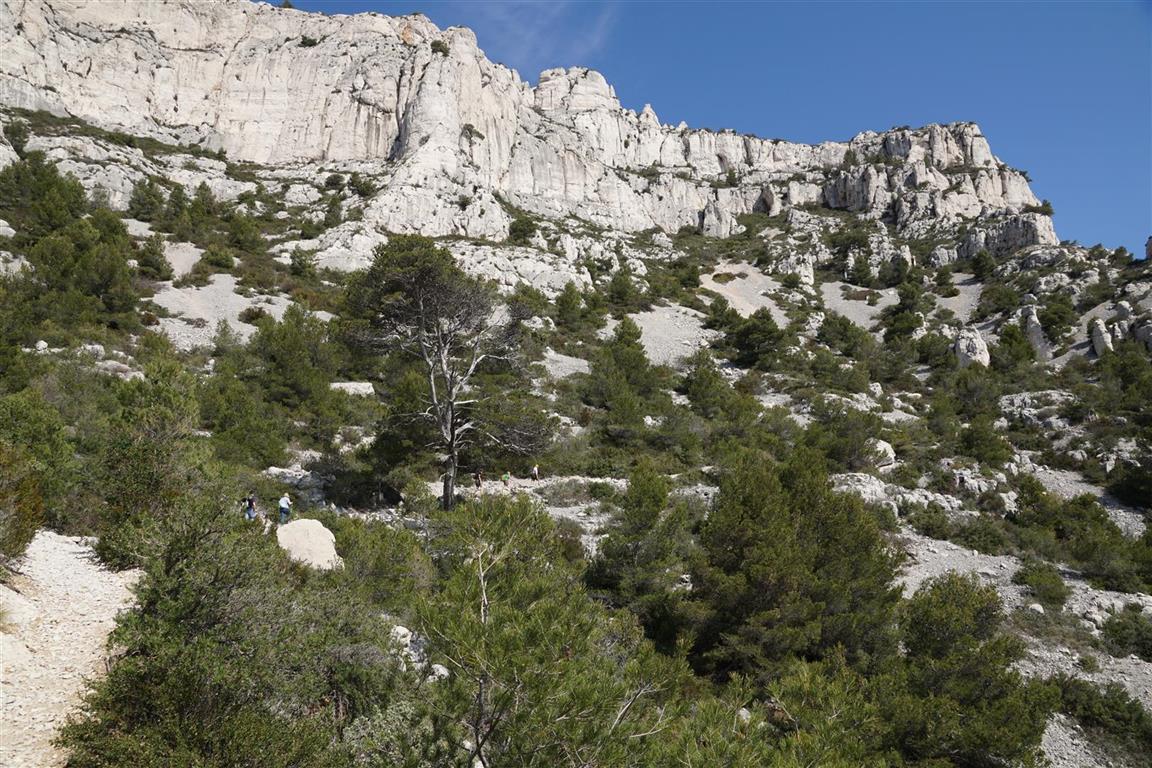


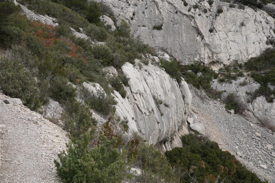
On day one, from Cassis, the trail follows the shore along the inlets of Port Miou and Port Pin. Then the route moves inland via the En Vau valley to the cliffs of Devenson. Disappointingly, there are no good sea views in this section, At the cliffs of Devenson however, a striking seaview opens up. After Devenson, there is a long climb to the Grande Candelle pass which affords a continous panorama of the coastline. At the base of this climb, looking up, there is no clue about where the trail leads and there is no visible gap in the imposing wall. But step by step the passage opens up and before long we crest the pass (more like ridge line) and head down the other side on a steep rocky trail requiring regular use of hands. Once down from the pass, a glance back towards the Grande Candelle (easily recognizable due to the the limestone needle that stands out from the massif) impresses. From here, the trail to the Luminy school of Architecture, where our taxi awaits, is easy. Planned time for this trail : 6,5 hours. Actual time nearly 8 hours. We spent (too ?) much time admiring the views.
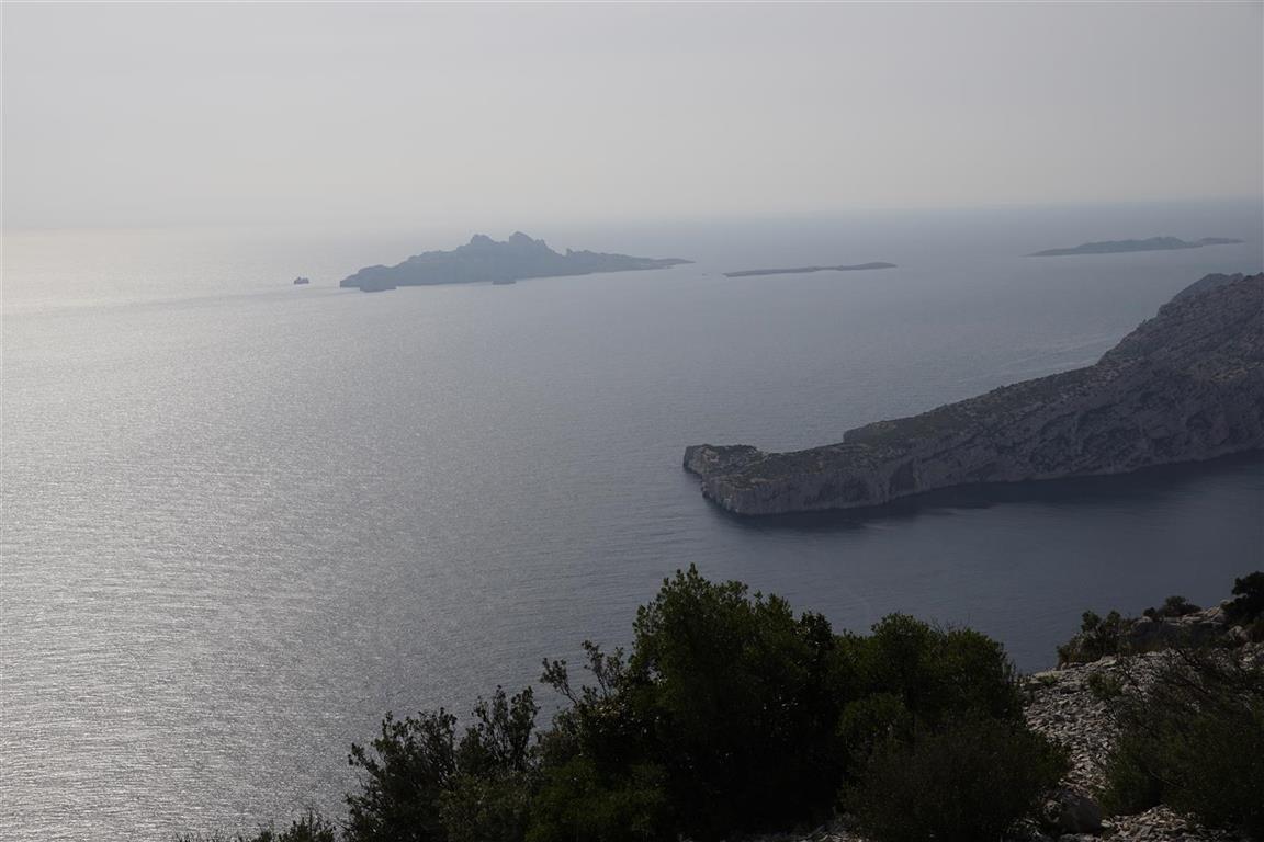
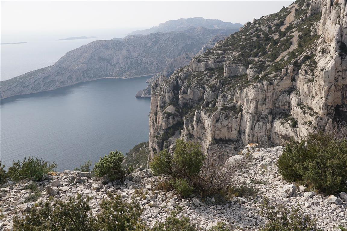
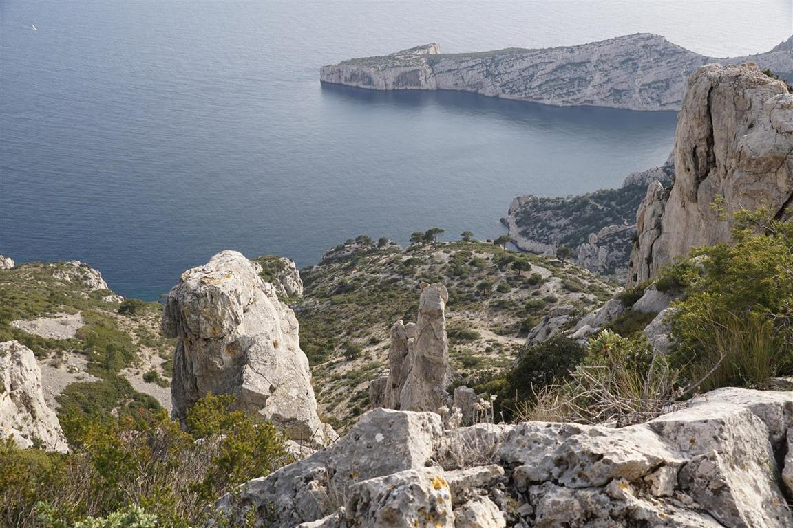
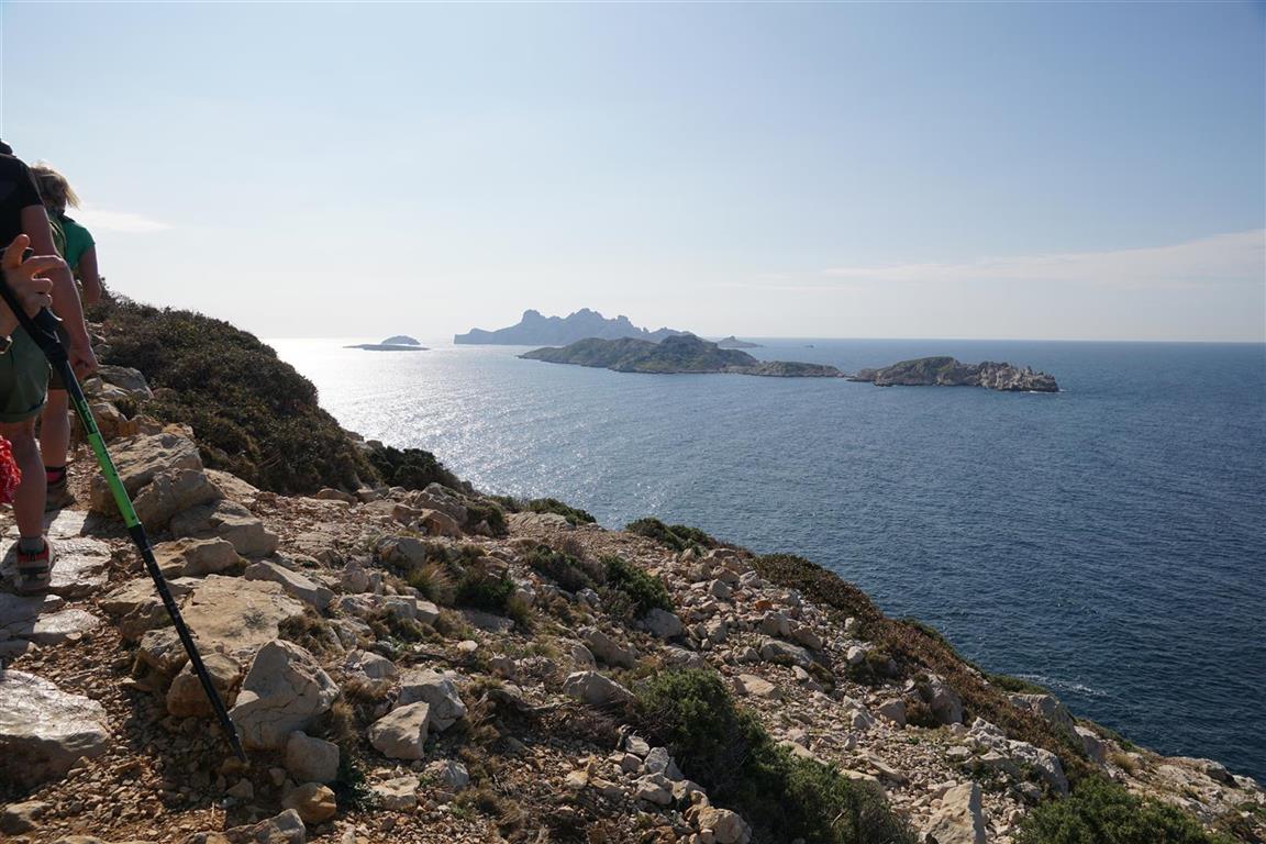
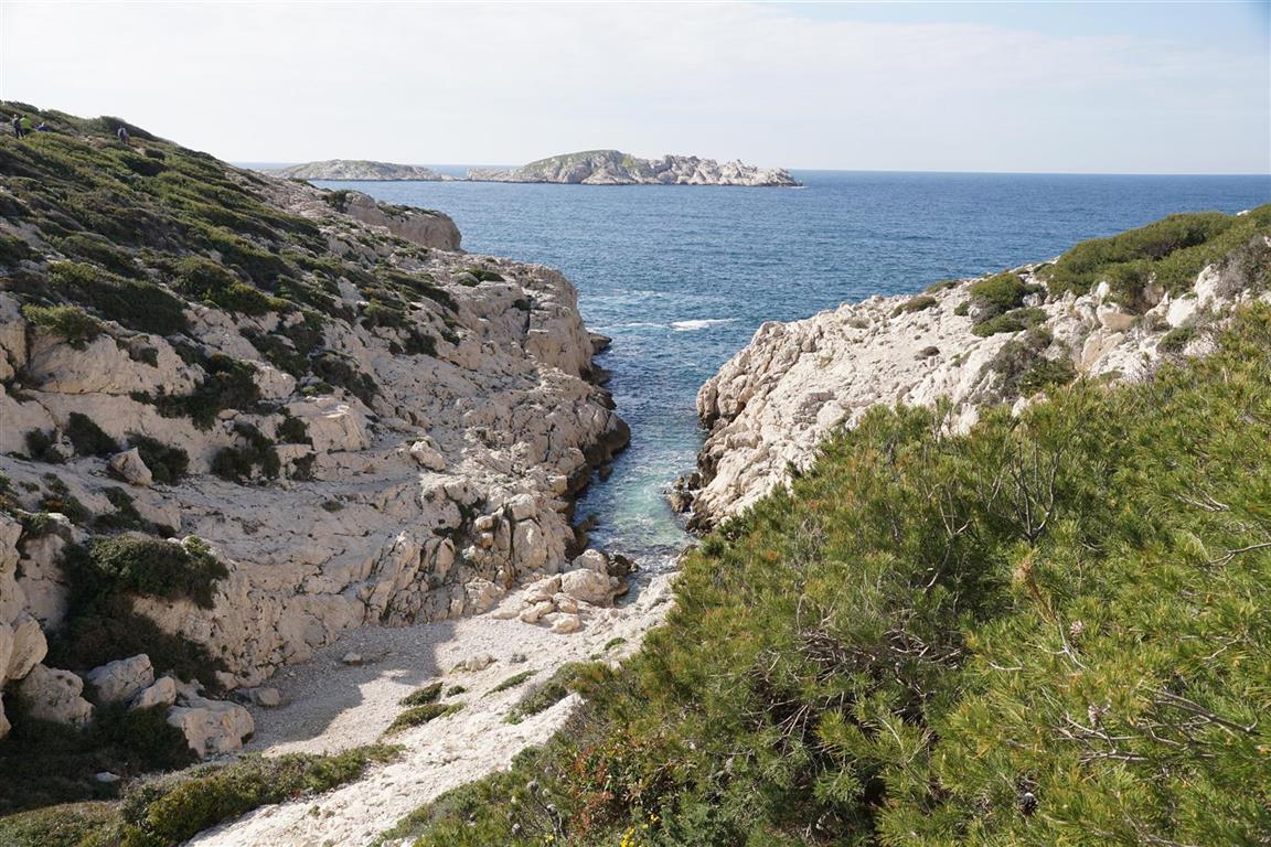
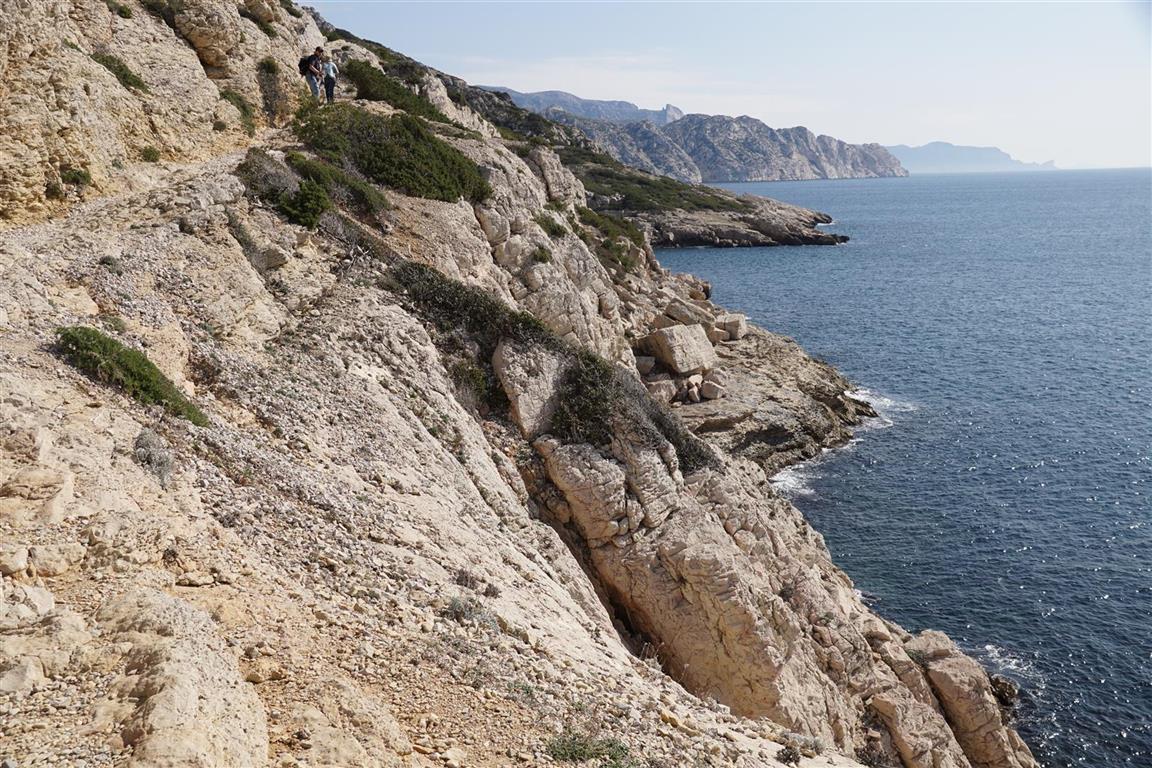
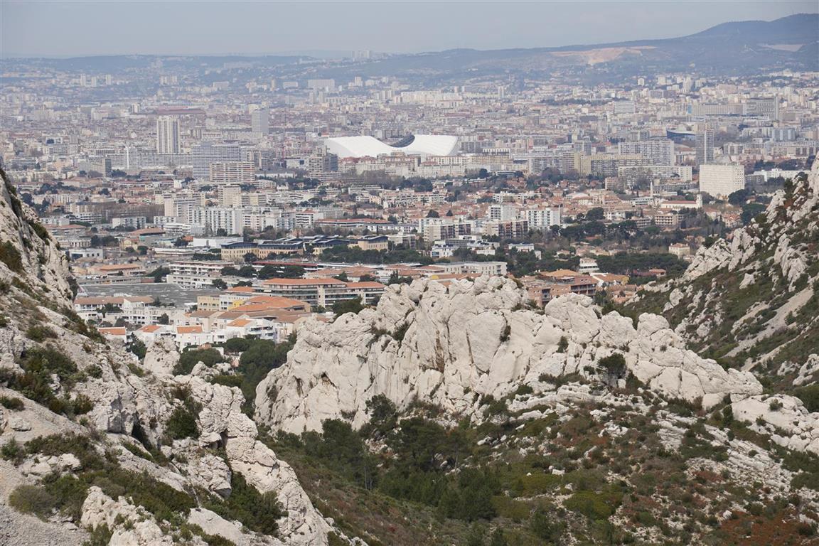
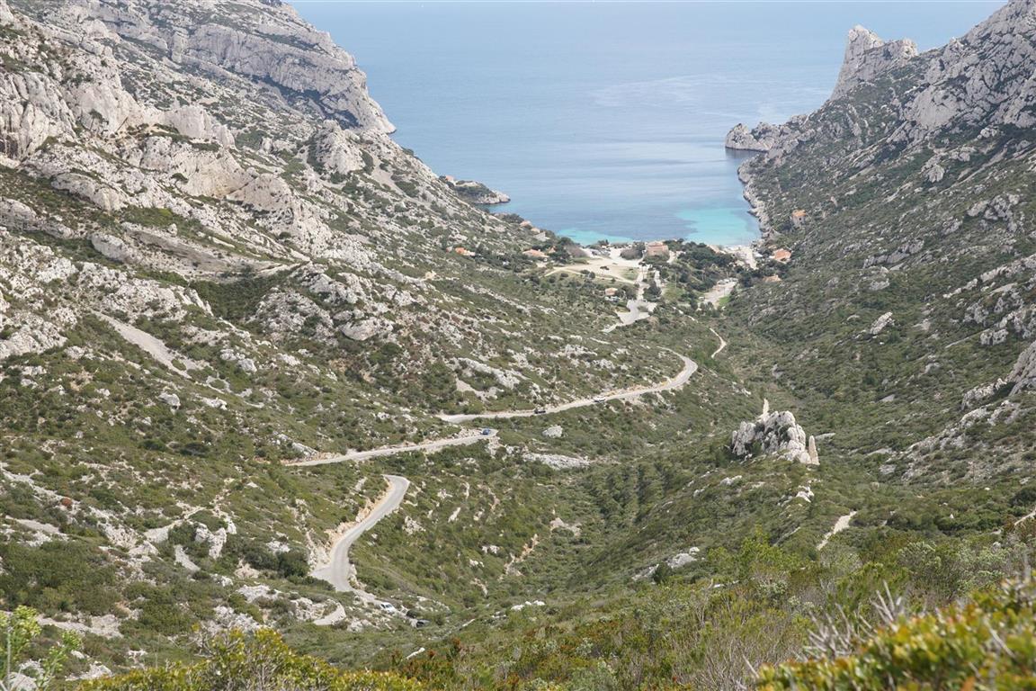
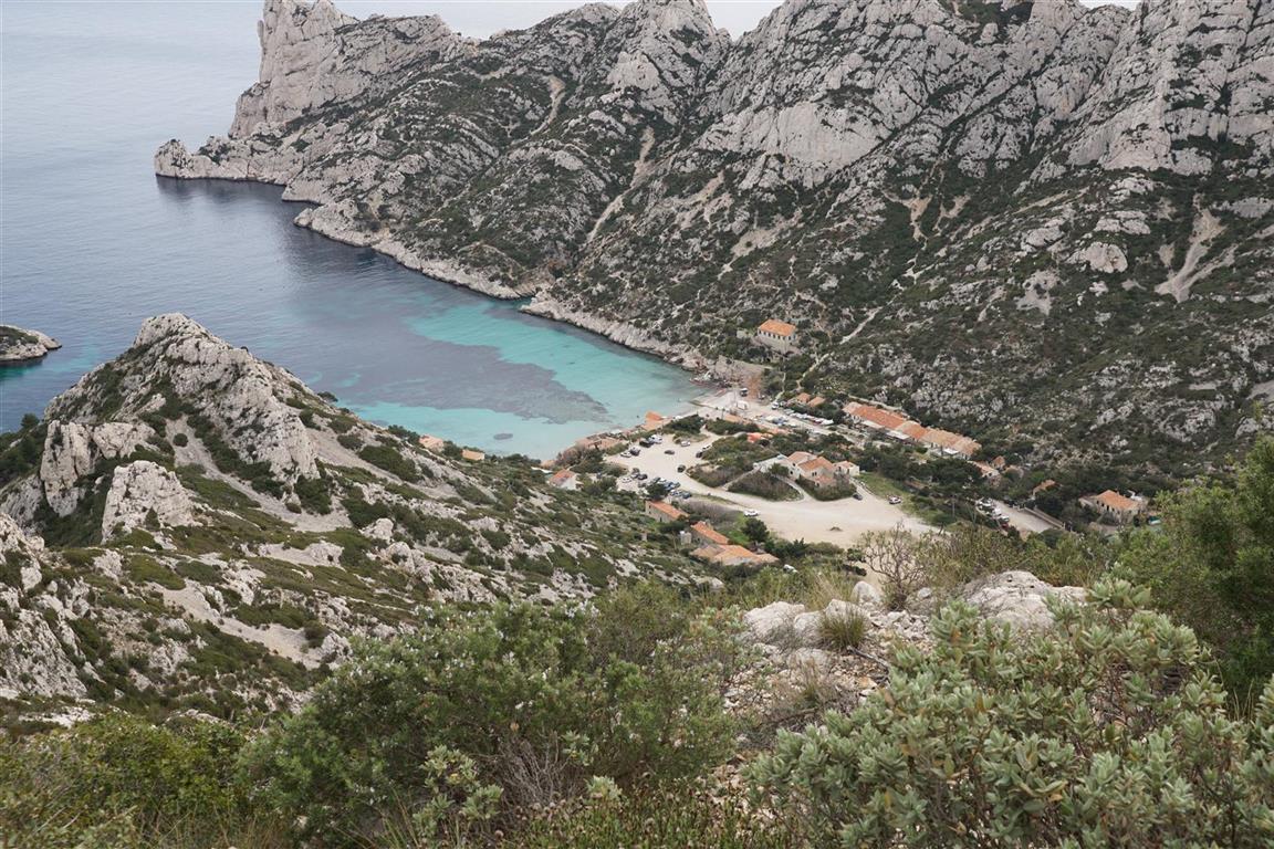
Day 2 starts with a taxi ride from Cassis to Callelongue – a small port in a cove in the extreme south of Marseille at the end of the coast road. From there, the GR east runs along the coast for a good distance passing near several coves including that of Marseilleveyre occupied by fishing huts and inaccessible by road. Then, the GR ascends gradually, still facing the sea until at the Podestat cove, where we see the traces of a very recent landslide that projected a part of the cliff into the water below. After Podestat, there are beautiful views of the seacliffs towards the east and of the little islet of Melette. The trail now rises steeply towards the Col de Cortiou and for a while we walk at the base of large white limestone cliff, the Cirque de Walkyrie. Then we reach the Cortiou pass and descend into and interior valley with beautiful views of Marseille, the Vélodrome stadium and the church of Notre Dame de la Garde. At this point, depending on wind direction, a strong smell of sewers could spoil things for an hour or so – the trail runs directly above a major sewage treatment plant for Marseille At the next pass (Sormiou), we are looking 200 m down on the cove (more of a bay this time) and village of Sormiou – this one accessible by road. Finally after Sormiou, the trail skirts along the top of the Morgiou inlet before looping around the ridge of mount Luminy. And suddenly, almost by magic, we are back in Luminy – the end of our trail.