The group of trails described in this article allow interested walkers to see a number of places where remnants of 19th century railroad lines are still visible, sometimes abandoned, but often reused as roads, storage depots and private houses.
Three rail lines crossed the Uzège district in the 19th and early 20th century. These were :
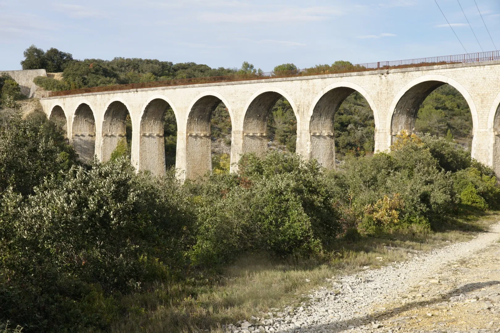
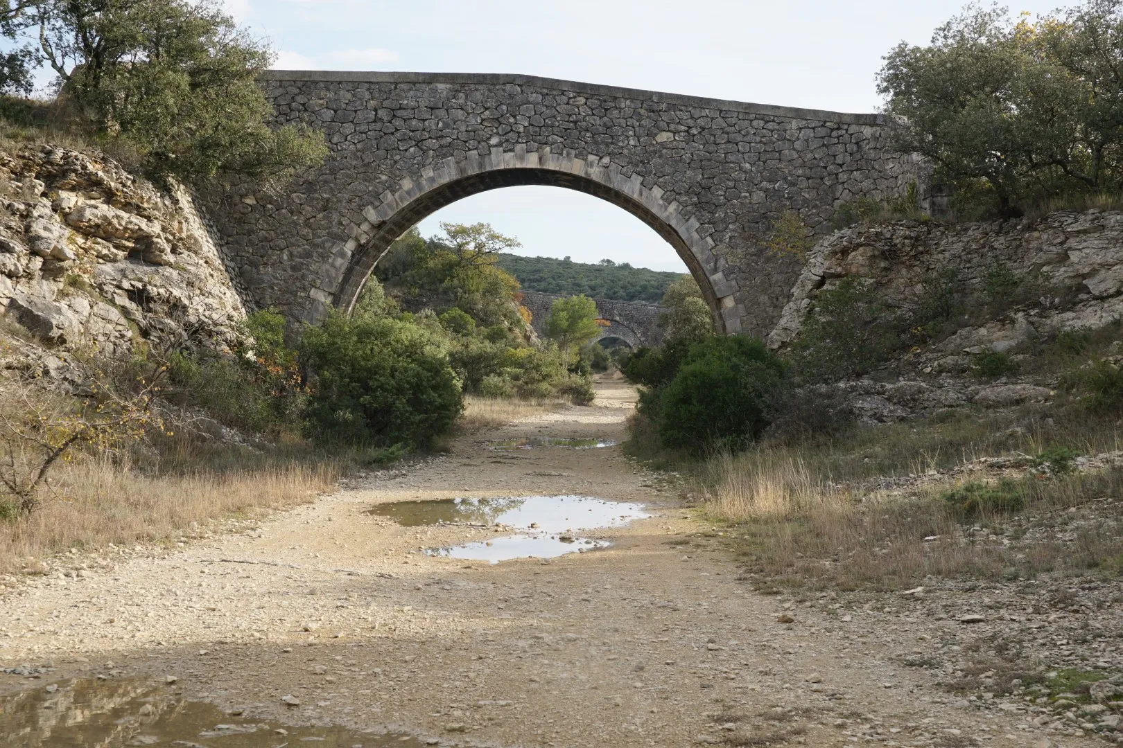
- A line from Beaucaire to Le Martinet. This one was built to transport coal from the Auzonnet valley to the Rhône river port at Beaucaire. Authorised in 1875, the line opened two sections in 1880 – one from Uzès to Remoulins and a second from Le Martinet to Les Fumades. These lines could immediately function as branches on pre-existing services. In 1883, the remaining sections were opened. Passenger traffic was suspended in 1938 and sections were progressively closed up to 2006. In 2018 after final administrative closures, several sections of the line – in particular from Beaucaire to Uzès – have been converted to bike and pedestrian walkways. The sections of this line explored in the following walking routes, all to the west of Uzès, have yet to be rehabilitated. Major engineering works still visible on this route include the viaducts in Euzet and the 400 m rail tunnel in Celas, both of which are visited by the walking routes below.
- A line from Laudun-L’Ardoise to Alès : Contrary to the other 2 lines, both granted to the Paris-Lyon-Mediterrannee rail operator, this concession was granted to ARM (Alais-Rhône-Mediterranee). Ostensibly this would be to compete with the PLM operation in transporting freight to the Rhône via an alternate, quicker route. But the line may have been unsuccessful from the start as the terminus in Alès was not that close to coal mines. In fact the terminal station was in the Conilhères area of Alès, near the main PLM station, but due to commercial disagreements this line was not interconnected with the Cévennes mainline. Ultimately, like the others, the line was closed to passengers in 1938 and totqlly closed to freight by 1954. Some references say this line was never profitable. The modern highway between Bagnols and Alès uses a substantial portion of this line between Seynes and Brouzet. Visible remains of this line include the Saint-Laurent station – now a private home.
- An 18.9 km line from Uzès station to Nozières connecting Uzes to the main Cévennes route (Nîmes through Alès to Clermont-Ferrand). Construction of the line was authorised in 1875 and it was opened in 1883. The line was closed to passengers in 1930 and steel rails were removed from the line during the second world war for other uses. The early closing of this line suggests that it was never particularly profitable. Major engineering works included a viaduct over the road from Uzès to Arpaillargues – still visible today – and a bridge over the Gardon river near Moussac. The Moussac bridge foundation was re-used in the late 20th century to build a new highway bridge over the Gardon river.

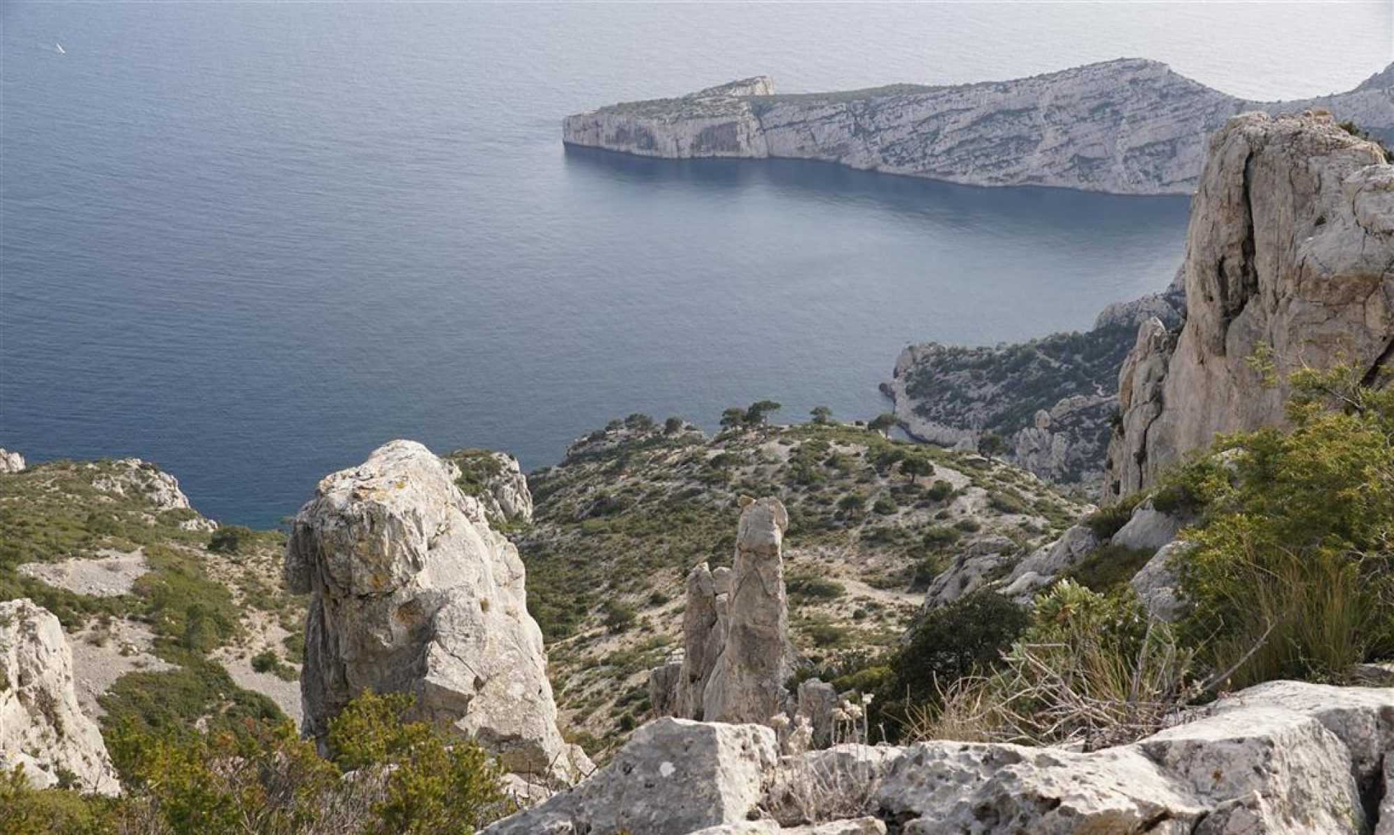
The interactive map below displays the approximate route of each of these 3 lines in the western Uzège district. The altitude profiles are approximate only.
Approximate rail routes
Section of line from Laudun to Alès
Complete route Uzès to Nozières
Section of Beaucaire-Martinet line
The walking routes
Exploring the line from Beaucaire to Le Martinet :
These 3 walking routes explore sections of the line from Beaucaire to Le Martinet. West of Uzès, the line traverses Montaren, Serviers, Foissac, Saint-Maurice, Euzet and Saint Just. The major civil engineering sites are the viaducs in Euzet and the tunnel in Celas. The walking trail in the Bouscarasse area follows the old rail route for several km through a wet forest where it is possible to observe the numerous cuts and embankments needed to cross this wet area. The tunnel in Celas can be traversed on foot (rechecked in 2021) but the poor light in the center of the tunnel means a flashlight or forehead lamp is advisable.

Exploring the Uzès to Nozières line
The loop below starts in the small hamlet of Aureillac and after passing a section of forest, reaches a foot bridge over a deep cut used by the line to limit roadbed slopes. Further along this walk it is possible to see a significant viaduct over the main Uzès-Arpaillargues highway (slightly off the walking route). Both this structure and the preceding deep cut trench allowed the track to maintain a fairly uniform slope as it climbed out of the Uzès station to the higher ground around Arpaillargues.
A short walk near the line from Laudun to Alès
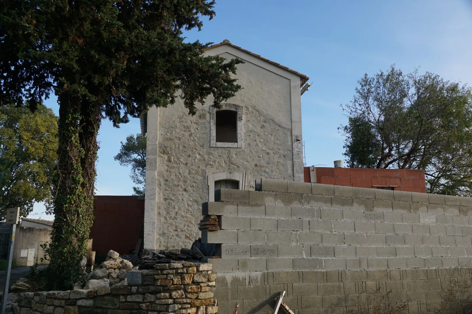
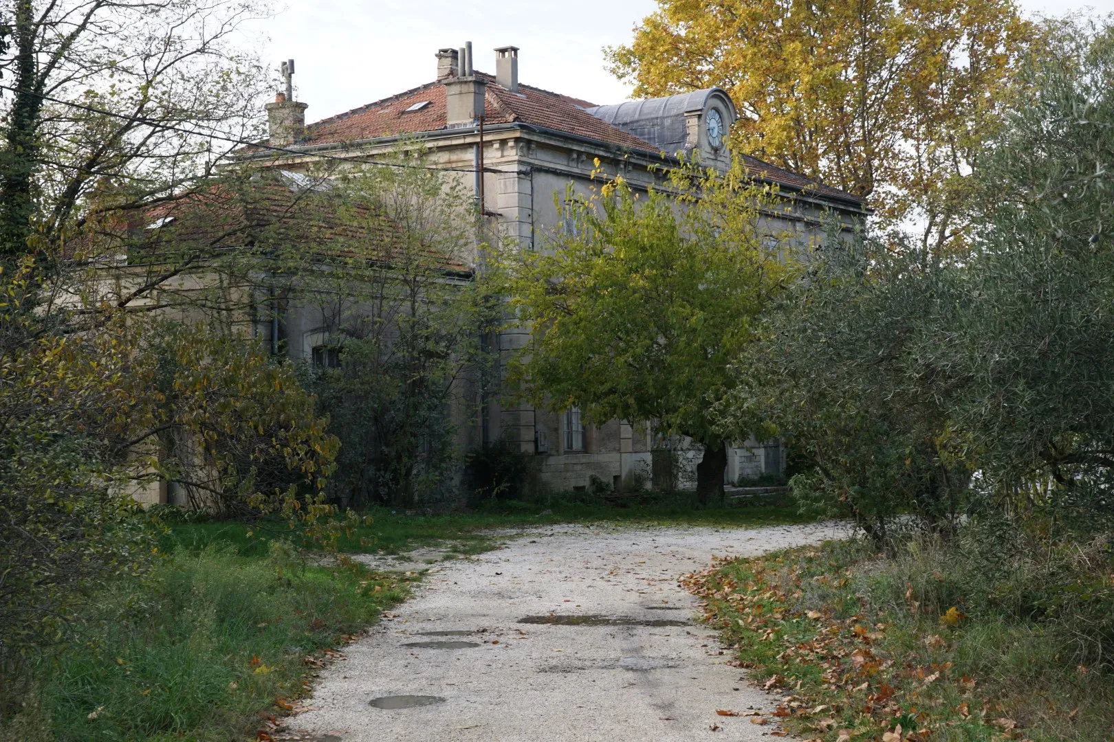
On this walk, it’s possible to see a large former rail station now converted to a private home. Near the station a number of barns, garages and sheds seem to hark back to the railroad days. It looks like there was a substantial freight operation around this station near Saint-Laurent-la-Vernède. There is an abandoned ocre quarry along the route. Perhaps freight from this quarry was shipped via the Saint-Laurent station .
Walk and look
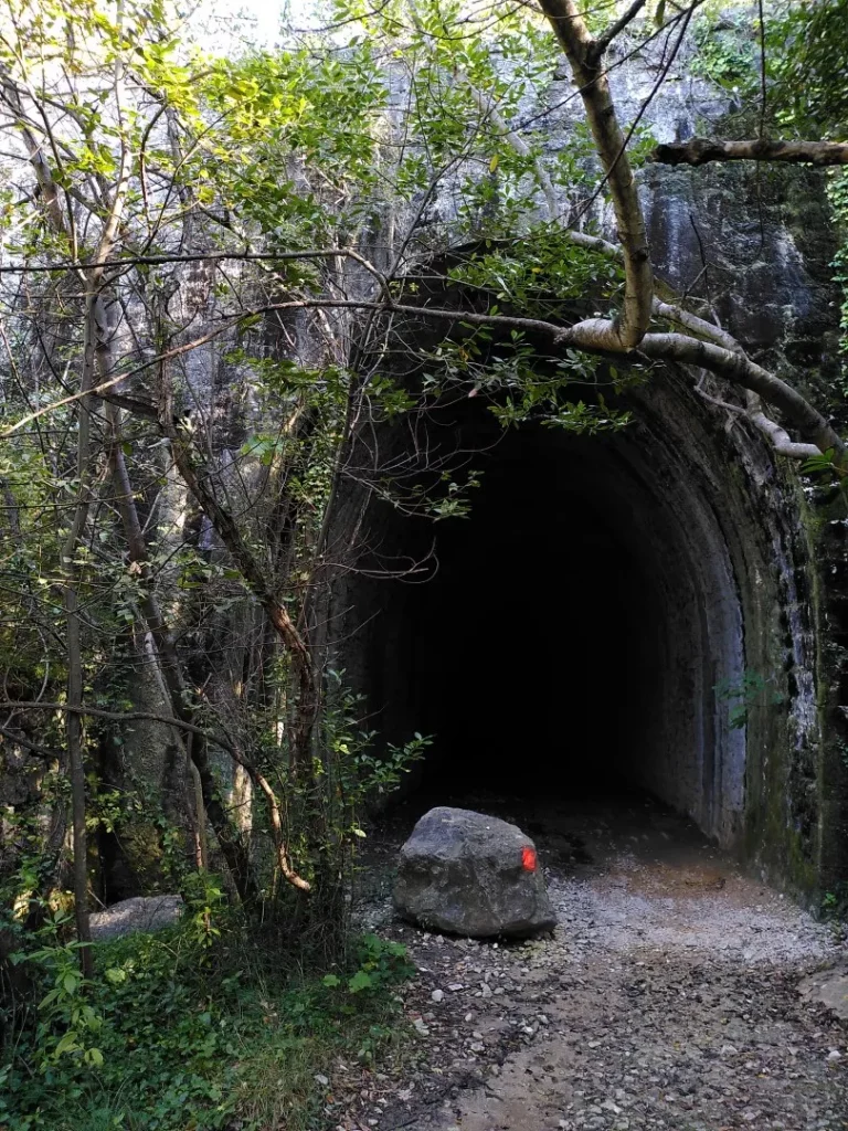
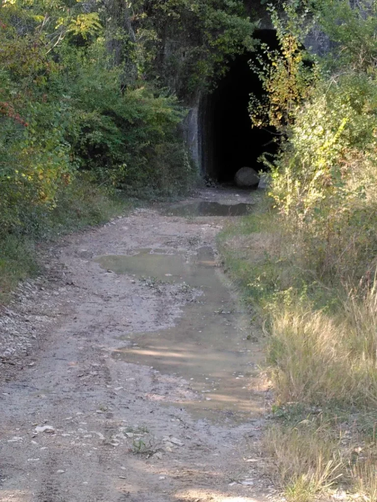
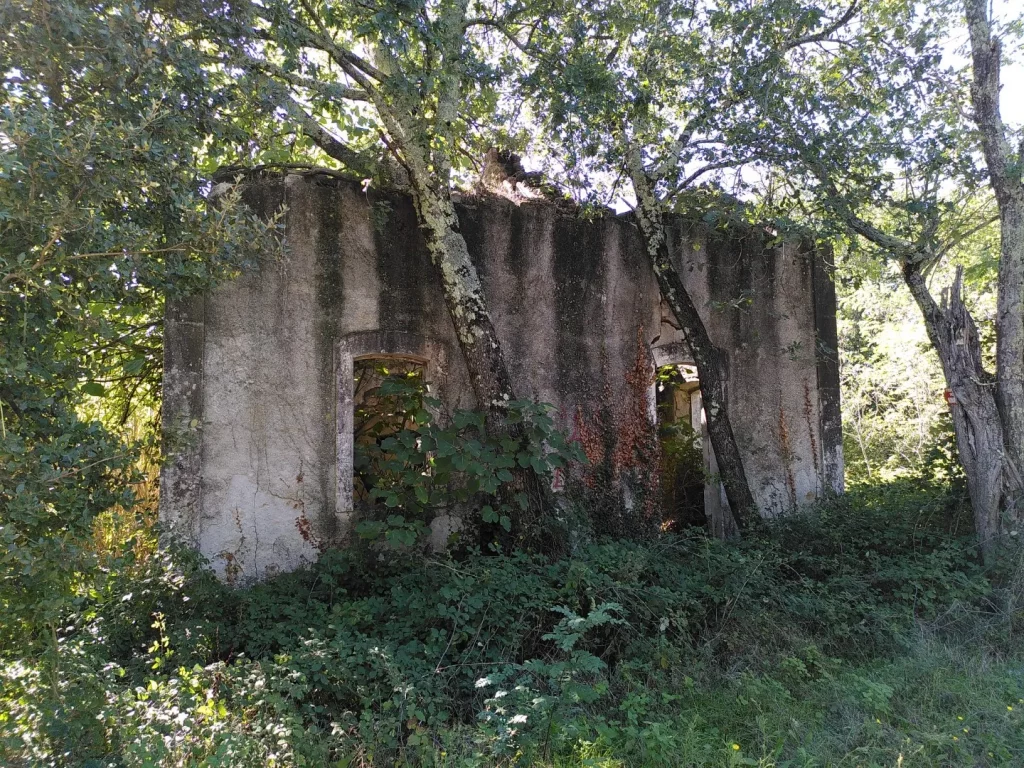
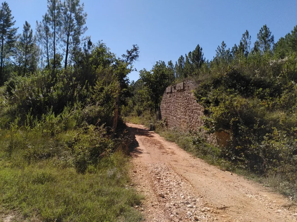
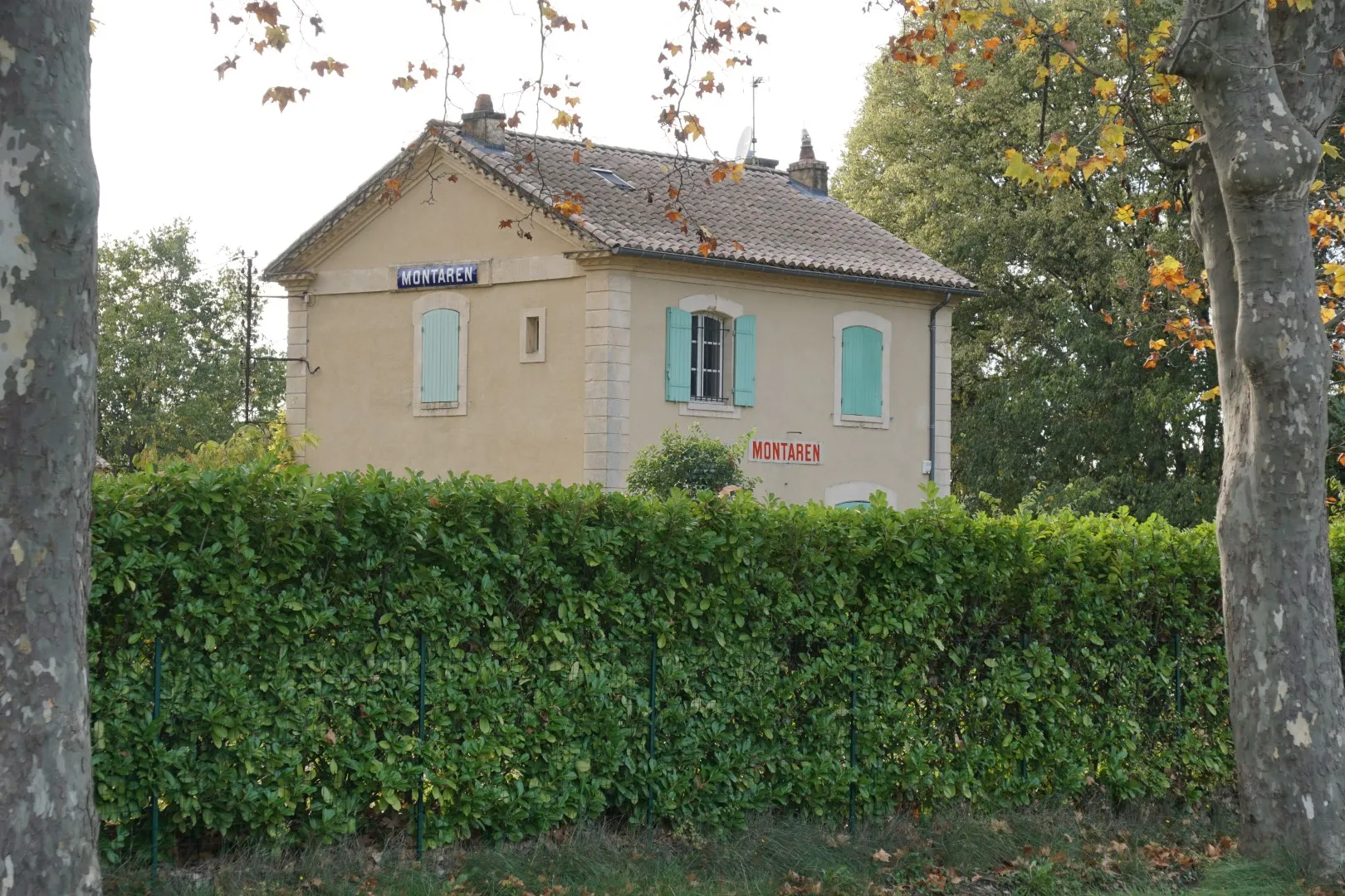
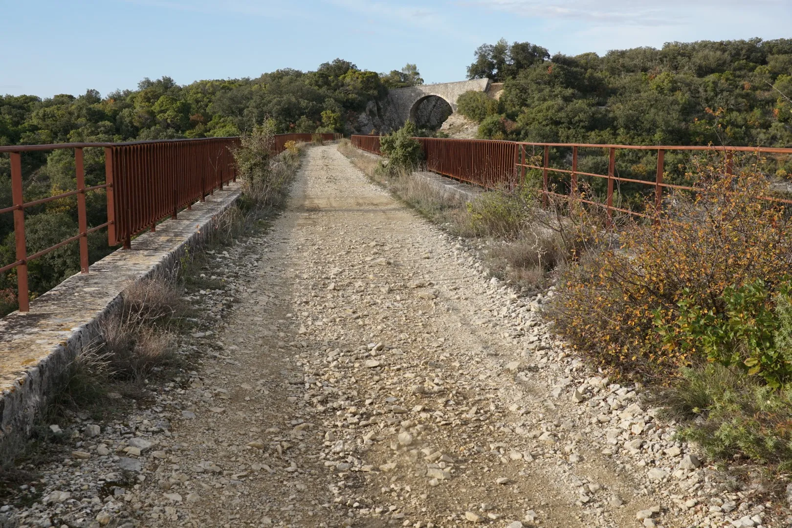
In many cases, the former rail route has been converted to road or track, sometimes to bicycle paths. Old stations, identifiable by their distinct 19th century “railroad” style are still in use almost everywhere – as private dwellings. Apart from stations, there were various technical buildings along these tracks – some served as residences for barrier guards. Some of these are ruined – an example is visible in the Bouscarrasse area. Bridge foundations have been reused for roadway. A substantial section of the D6 from Bagnols to Alès reuses the old track bed near the Seyne cliffs. In other cases, for example near Maruejols-les-Bois, the ballast has been removed and the track right of way is now a muddy mess. In a number of cases the rail road passes over other roads or tracks. In many cases the abutments are present but the bridge deck has disappeared. The viaducts in Euzet are large and apparently unmaintained. Sooner or later walking across these viaducts will become impossible for safety reasons. The rail tunnel in Celas is quite passable (with a flash light) but also apparently unmaintained. If a section of the tunnel roof were to collapse, the tunnel will certainly be closed. It is a testimony to the solid engineering works of the 1880’s that these things are still standing. Remember that most of these structures would have been built without mechanical digging, lifting, or earth moving equipment.
The pictures in this article were mostly taken between 2020 and 2021. The author personally walked these routes in 2021. Never-the-less, a walking route is never permanent. Routes can be closed, re-routed. Tunnels and bridges may become unsafe and impassable etc. Use the data with care.