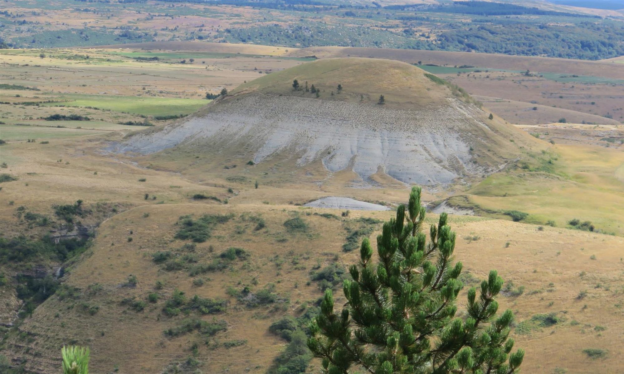
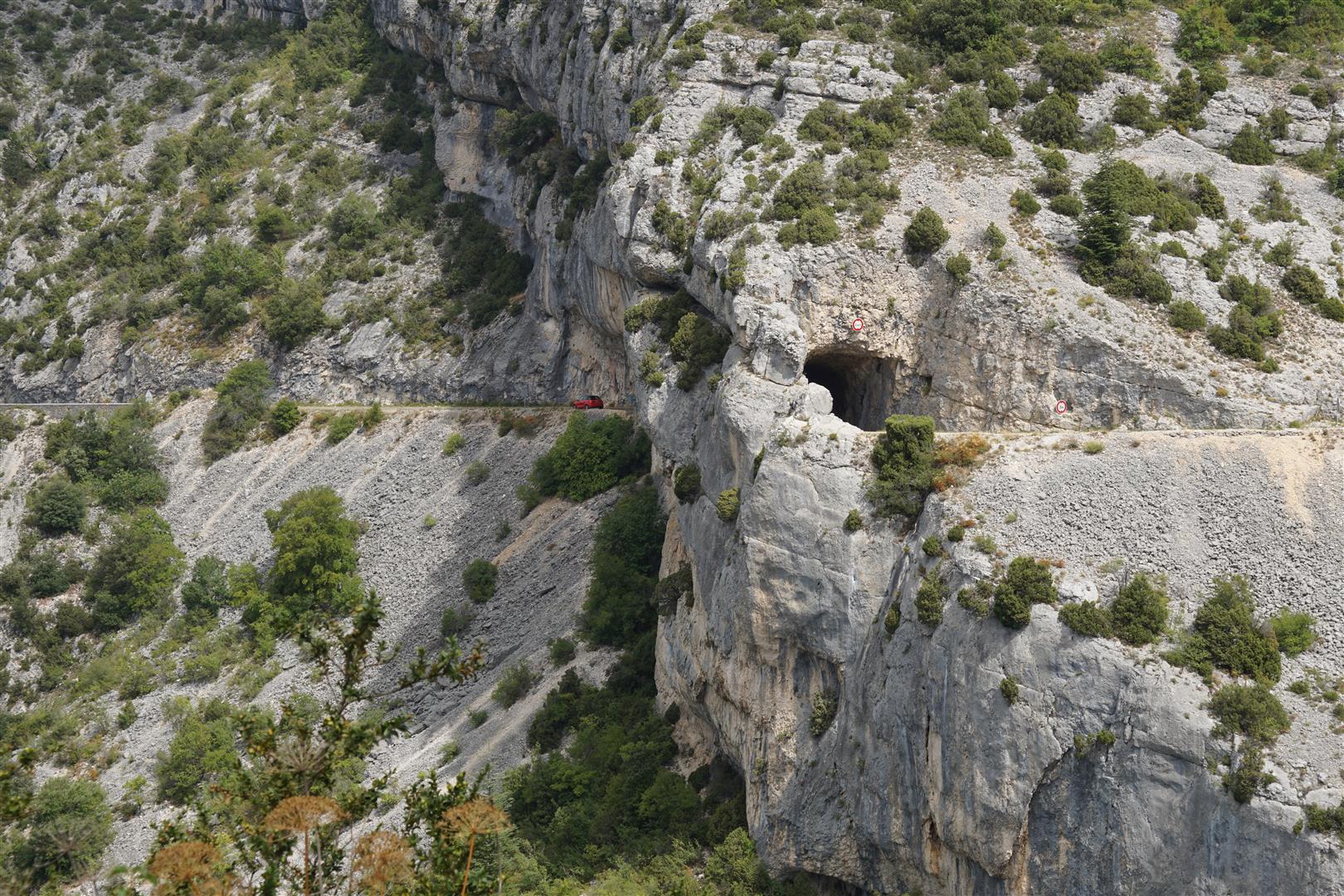
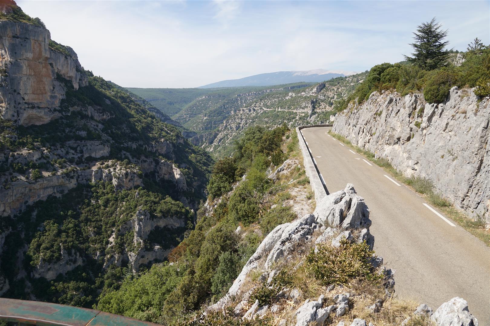
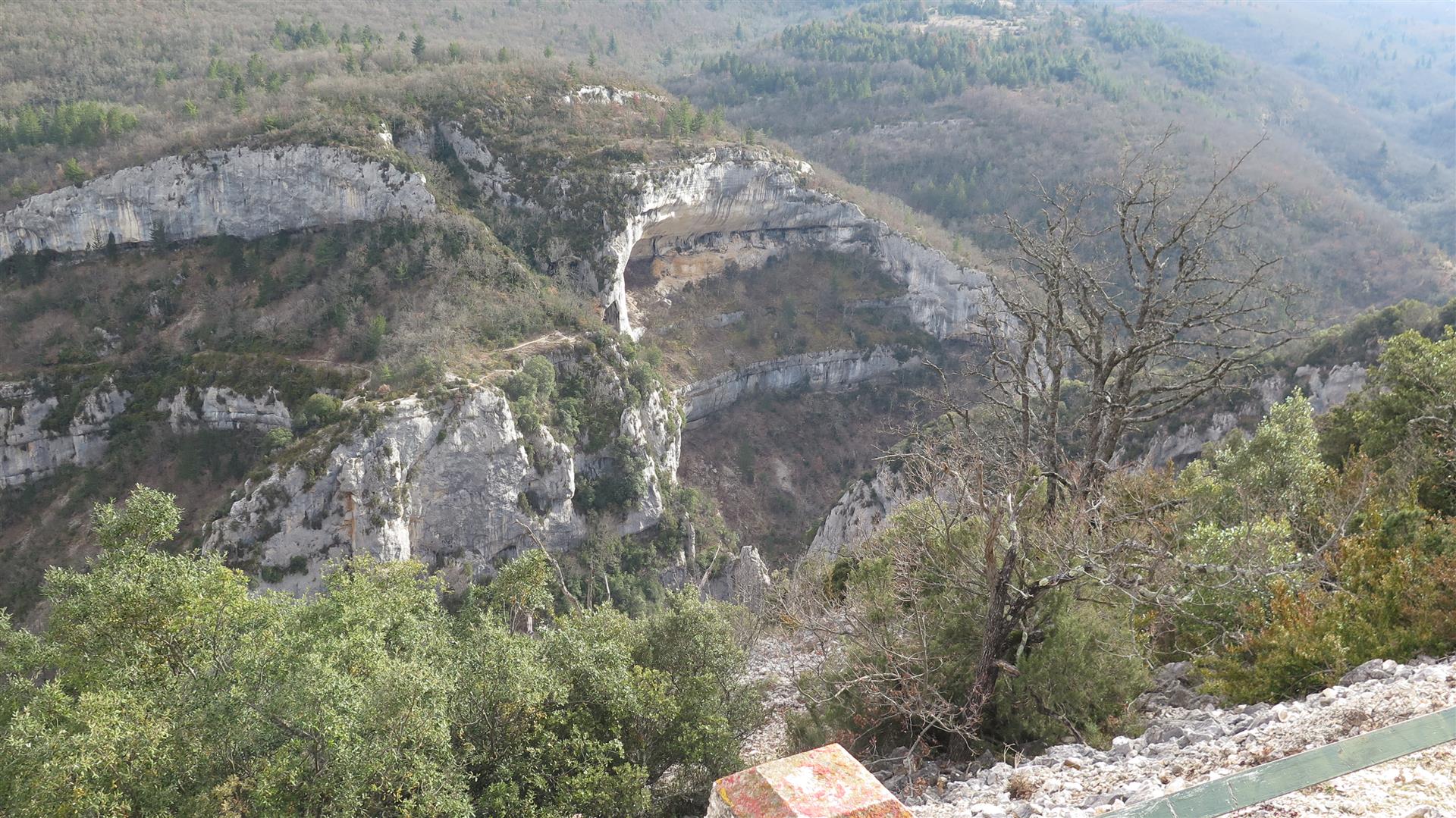
Over the past 3 years, I drove the Nesque Gorge highway a couple times. It’s a spectacular route about 2/3 of the way up the canyon wall sometimes perched on a ledge and sometimes passing through cliff wall tunnels. With few places to stop, there is little chance to appreciate the scenery while driving.


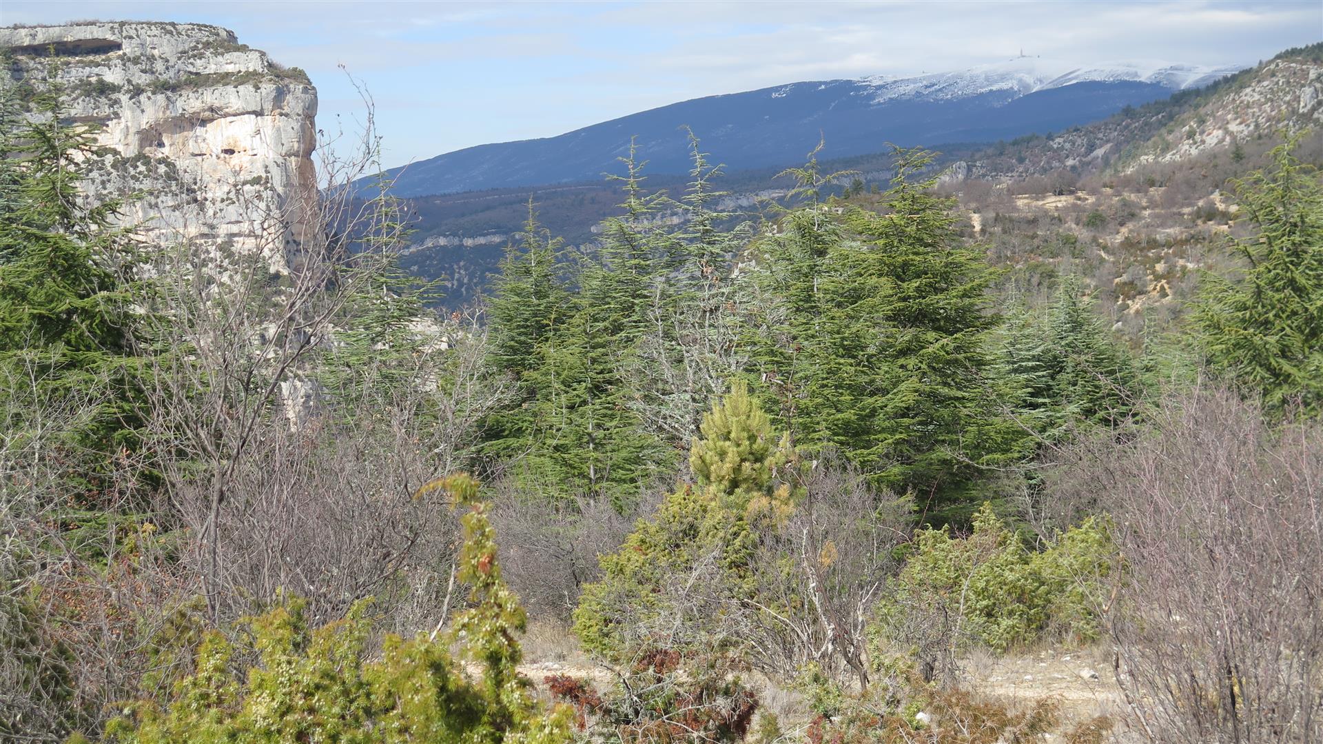
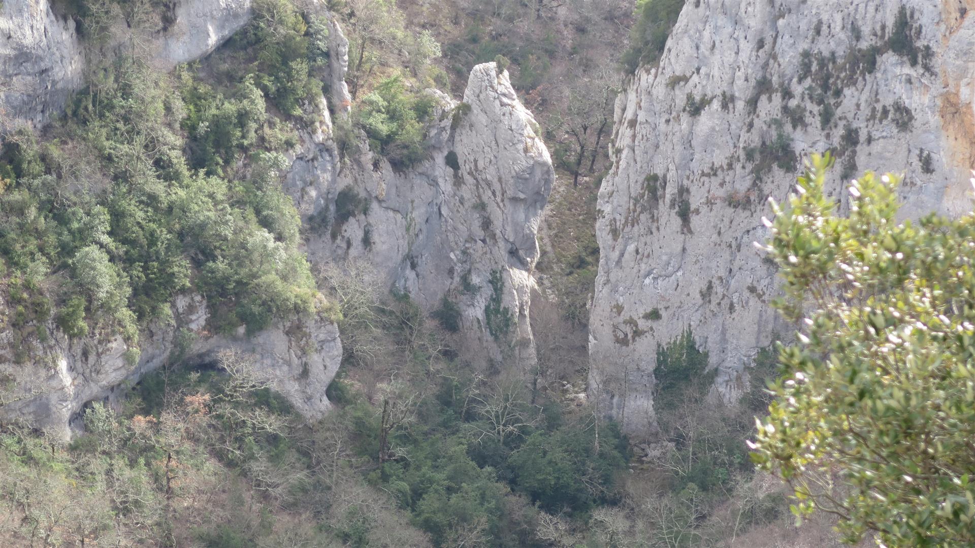
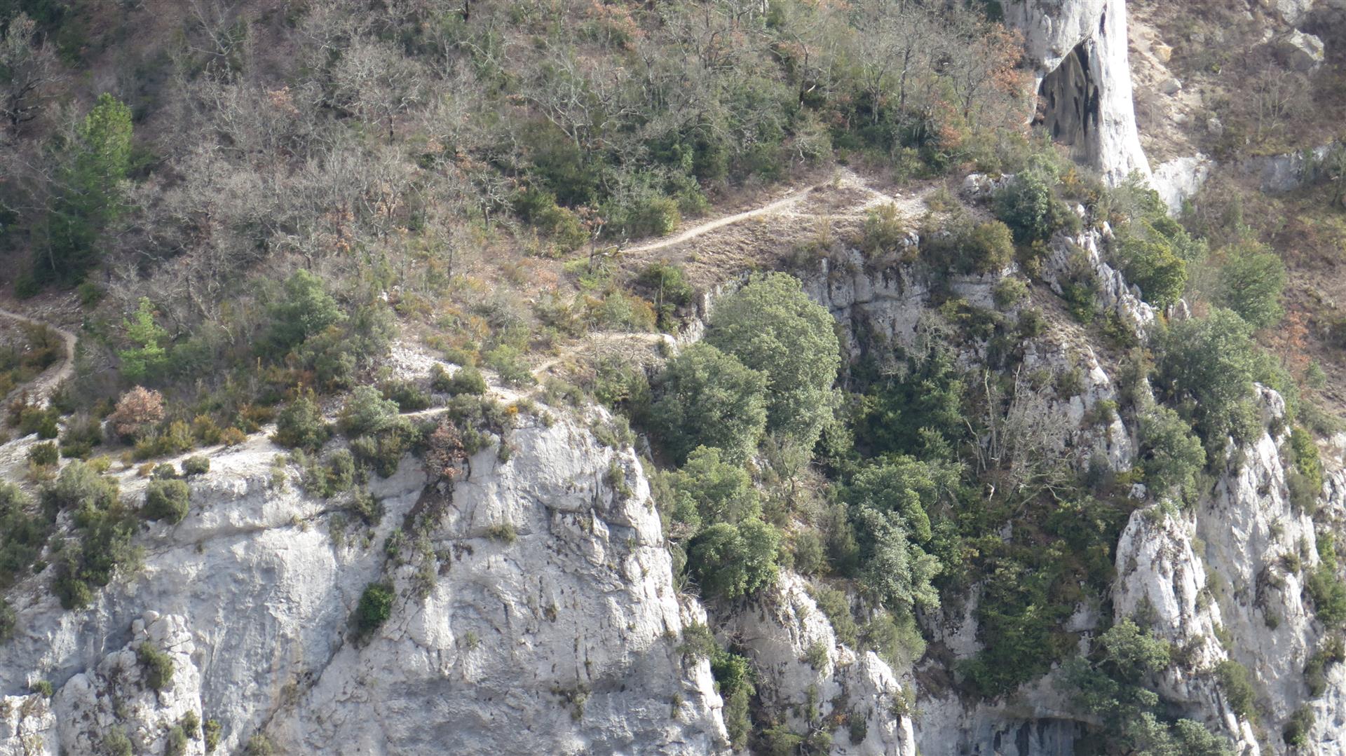
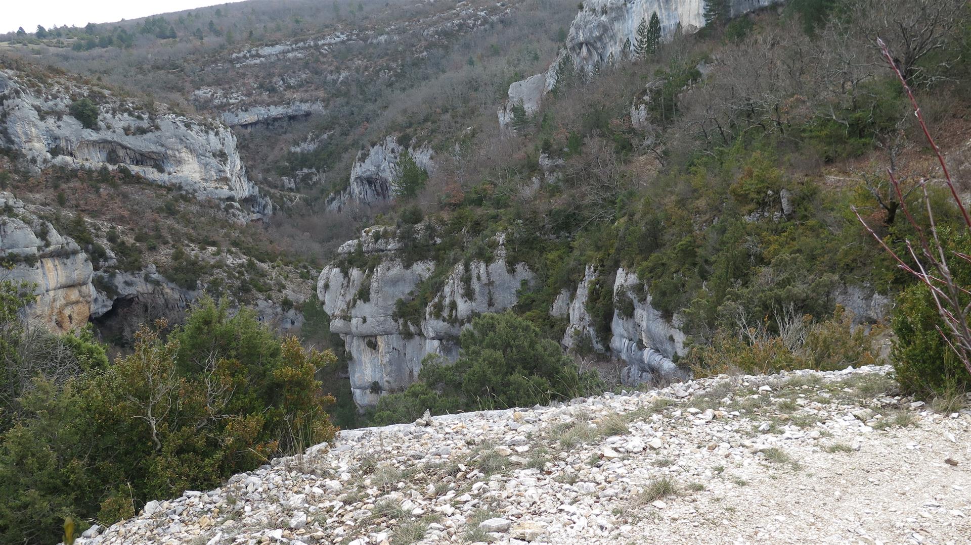
So at some point, this had to happen on foot. The only “approved” footpath in the upper end of the gorge is one documented in an FFR Topoguide. It starts at Monieux, passes a small pond and enters the gorge on the left river bank then climbs along the gorge wall to almost the same level as the surrounding plateau. This happens over about 4 km. Then the trail plunges down a steep incline to reach the bottom of the gorges where an ancient chapel awaits our admiration. From there the trail climbs back up the right bank to the Nesque Gorges highway and from there back to base in Monieux. Only on this day, we did not see the chapel. Halfway down the incline, we decided that the path (on a 2m ledge along a 50 m sheer cliff) was too slippery for comfort, and we turned back. After having lunch in a scenic spot (snow on Mount Ventoux, and the Cire Rock in the foreground), we were contemplating our failure to make it across to the right bank. Then, bright idea, we notice an alternate path on our maps that seems to lead across the gorges to the highway on the other side. Looks steep but maybe not as many sheer cliff walls, so we strike out. The first few hundred metres are easy, following a wide grassy path on a gentle downward slope along the bottom of a talweg. Too easy it turns out. This easy trail deadends at a sheer cliff and we turn back again. This time to find another narrow path that heads toward the bottom of the gorge. This part of the trail looks like it is seldom used. A bad omen. But after more effort we reach the river bed at a spot just downstream from a narrow cluse about 4m wide with water from cliff wall to cliff wall. No exit that way. Still, it is possible to ford the river and head downstream. This being southern France – there is never much water in these limestone gorges unless a thunderstorm has broken upstream. There’s not much evidence of a trail on the right bank either, but we know we have to go up so we move on. The trail is there but marginally visible and heavily overgrown – to the point where we have to crawl under some of the undergrowth. This becomes exhausting. After almost giving up on this trail, it breaks into open ground on a 30% slope and we head uphill again. After scrambling over some steep rocks where both hands are needed we find a relatively easier path and finally emerge at the Nesque Gorge highway some 160 m above the river level. A climb of 160 m is not too difficult, but this was frequently on 30% slopes and over a maximum horizontal distance of 400 m. Because we are a bit tired, we decide to skip the trail that climbs another 150 m above the highway and head back to base using the road instead.
Back in the town of Monieux, we drop into the local tourist info office. There is not a soul in sight – this is February and tourists are all in the ski resorts. The lady in the info office tells us that the only authorized trail crossing the gorges is the one to the chapel – the one we decided to skip. All the other trails were removed from the IGN hiking maps in 2008 and are no longer maintained. Apparently the trail we took was created in the 1960s as a training ground for army recuits from a nearby military base. The tourist office lady first thought we were sissies for crapping out on the official trail only to decide that we must be crazy to have taken a trail that she considered “much more difficult”. Tough, yes, but no slippery tracks along 50 m cliff edges. So we agreed to disagree with her and moved on.