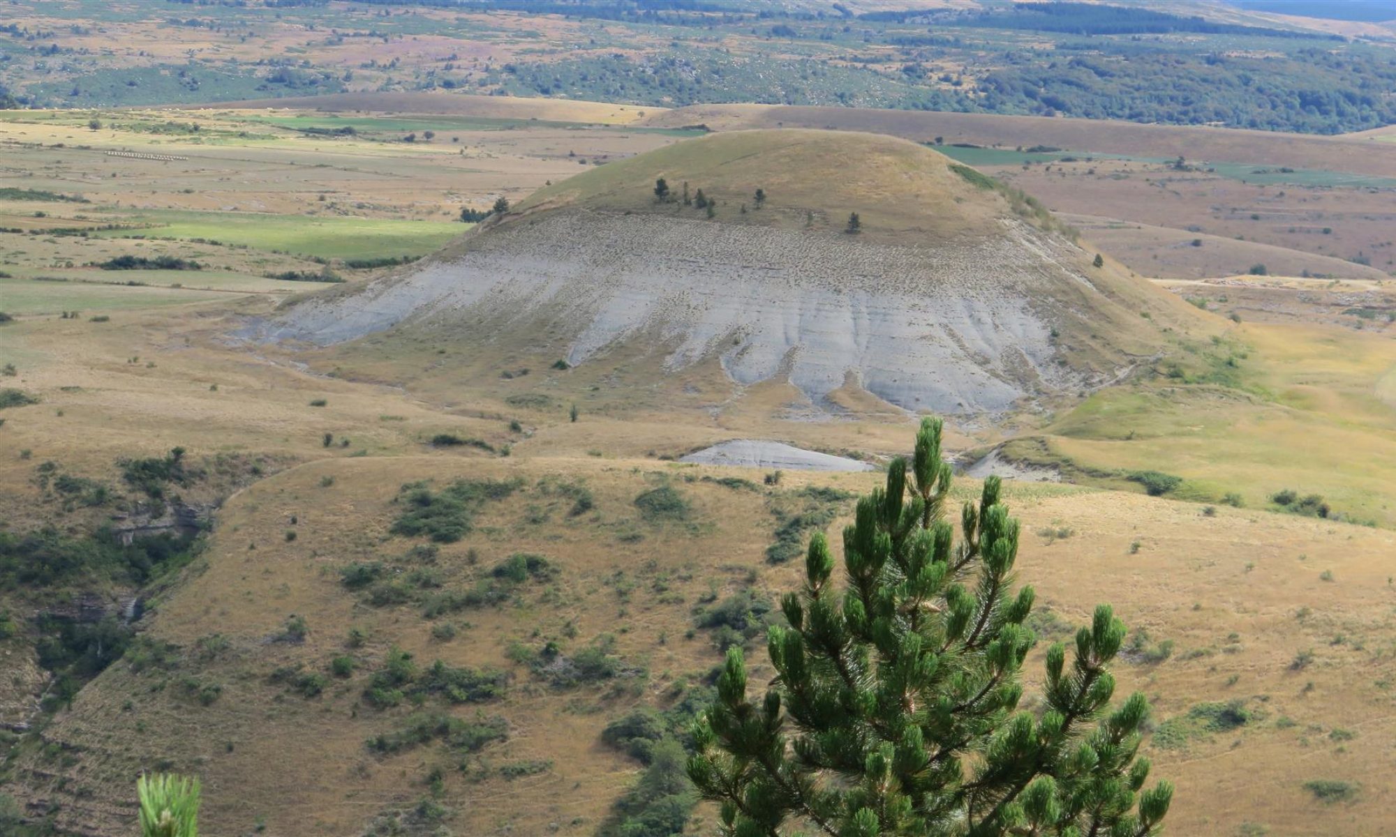

I used the Garmin GPSMap 64S to record a track of (theoretical) distance 10.1 km. On the same hike, I turned on the trackers for 2 smartphone applications described below.
First is the Android app – Ultra GPX logger (cost about 5 €). This app’s primary focus is logging GPS tracks. The app can create GPX, KML, NMEA or CSV track logs. It is able to stop logging to save battery when the device is stationary (the Garmin GPSMap 64s does not know how to do this and consequently adds error to the track record). The app also uses a Kalman filter – a mathematical technique to filter out noise in the altitude recordings and (theoretically) provide better accuracy. This might be used on the Garmin too, but I did not see any mention in the docs. There are bunch of other settings and I am far from sure if I set it up properly. The app does a very good job on logging longitude and latitudes too. The app lets you export track logs and view them on a base map. For altitudes, we’ll look at some charts below.
Second is the Android app – Orux Maps (free). This app has more functionality than Ultra GPS Logger (e.g. logging heart rate if you wear an HRM belt) but still does a good basic job of logging the track, displaying it on a base map, providing speed and altitude charts, etc. The app is a bit hard to get used to as it makes use of multiple icons for navigation. Several of the smartphone apps I tried have this problem which a result of the limited space on the smartphone screen.
So here are the charts.
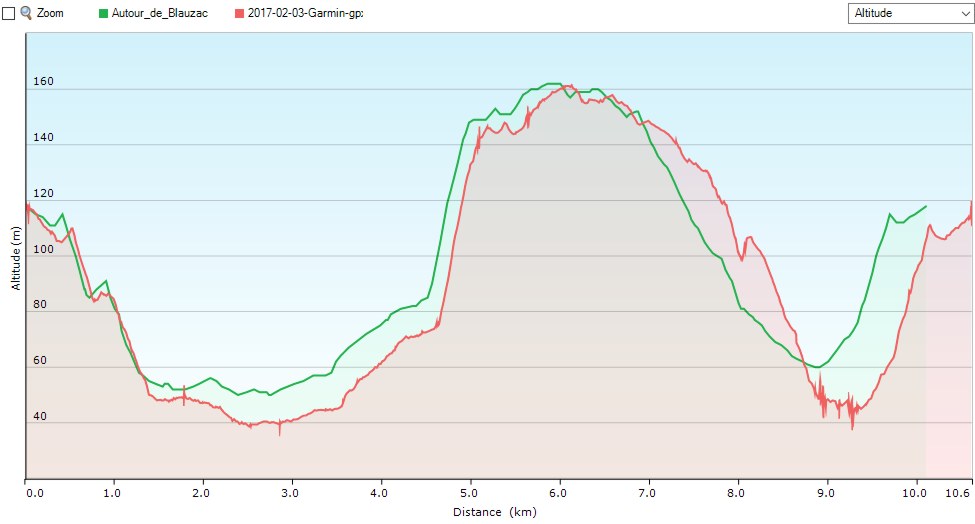
Click for Garmin vs theoretical
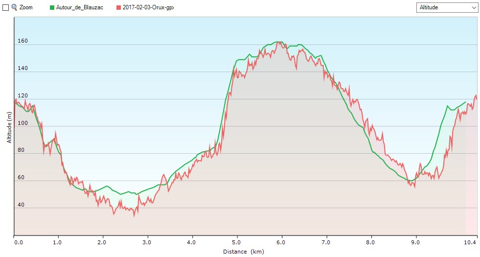
Click for Orux vs theoretical
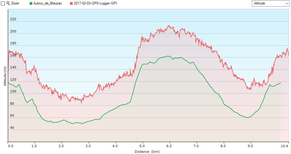
Click for Ultra GPX Logger vs theoretical
Some conclusions
The Garmin device is better than the smartphone apps overall. While it overstated distances it has a much smoother reading on altitudes. The smartphone altitude profiles are very jaggy – indicating lack of stability of the GPS meansurement. Perhaps this is just the smartphone chip quality.
The distance readouts are better with the smartphone apps. This is likely due to the ability to stop recording when the device is stationary.
The experience during this trial leads to some other unrelated observations though. Viewing a smartphone screen in bright sunlight is a non-starter. Carrying a smartphone by hanging in on your backpack or your belt is ill-advised. And battery life is badly affected by continuous use of the smartphone over a 3-4 hour walk. Smartphone apps often rely on network connections to obtain basemap tiles. The Garmin with large screen fonts, interchangeable batteries, and rugged build has none of these issues.
Overall Garmin wins hands down on useability, but is closely pursued by (at least) one smartphone app in regard to track data quality.