GPSMap versus smartphone

When it comes to navigating a hiking trail, compared with 10 years ago we’re spoilt for choice. Numerous smartphone applications have carved out their niche since then. Visorando, VisuGPX, SityTrails, AllTrails are just the most well-known. These mobile applications – sometimes combined with a website – are often participative, allowing individuals to use trails posted by others: a kind of social network for hiking. You can plot trails on a map background, visualize routes, search for routes by region, and so on.
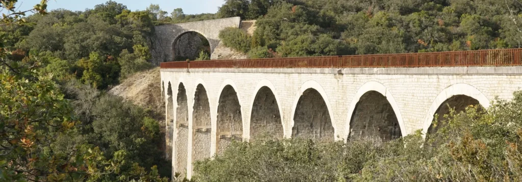
Trouvadou viaduct -abandonned rail infrastructure : Euzet

Before the emergence of these applications and sites, people used dedicated GPS-type handheld devices – similar to those in cars, but designed for use in the field, with pre-packaged maps and native functions in the device’s software. The aim of this short article is to propose a comparison between smartphone use and a Garmin GPSmap for navigating in the field and finding your way around etc.

The GPS device I’m referring to is the Garmin GPSMap 66, but the observations also apply to the 62 and 64.

Compare GPSMap vs Smartphone

Criterium Garmin GPSMap Smartphone
battery life 6-8 hr in normal use (tracking a walk) depend on phone and screen usage time
battery type 2 standard AA 1.5 v batteries (removable); can use rechargeables sealed in device
data and privacy location and usage data totally private location and usage data transmitted to tech giants and hundreds of data brokers
dedicated desktop app Garmin Basecamp (Windows) or Garmin Express (web app) not required
device build quality excellent, resists 1 m falls and water (but not full immersion) depends on phone and case
form rounded form fitting the hand slab
loading tacks connect USB to laptop and use Basecamp or File explorer download from source and open in app
maps : look like IGN 1:25000 blue maps ? no yes if available in mobile app
maps : other sources OpenStreetMap yes , depends on mobile app
maps : price Garmin maps are expensive. ex. 200 to 300 € for full France coverage free apart from eventual app subscription fee
maps : source Garmin via mobile app
maps : visual aspect Garmin style with 5 level of detail different map layers available depending on mobile app
maps:loading loaded via micro sd card inserted in device loaded in realtime if mobile network available or downloaded in advance
native software Garmin software provided with device varies depending on app chosen
needs mobile network no yes to stream maps while hiking
precision : altitude barometric or map based depends on gpss chip in phone
precision : location (long/lat) 3 metres depends on gpss chip in phone
satnav networks accessible gpss, glonass, galileo gpss, glonass, galileo, +
screen brightness good depends on phone screen quality
software functions 1 follow track yes
software functions 2 record track yes
software functions 3 navigate to destination depends on app
software functions 4 navigate on track depends on app
software functions 5 view altitude profile forward and behind depends on app
software functions other full gps functions, sighting, compass, barometer, clock, bluetooth connection to pair with HRM, wifi connection to share tracks, etc depends on phone and app
touch screen interface no yes
usable in one hand yes depends on user
user interface push buttons and thumb operated joystick touch
Showing 1 to 28 of 28 entries

Which appliance to choose? This is very much a matter of taste. For long-distance routes through areas without network coverage, GPSMap will do the trick. For short outings in France, the phone will be preferable. If you’re a fan of IGN 1:25000 blue maps, you’ll want to go for the phone, because Garmin maps, while very readable, aren’t quite as “pretty”. Conversely, if you want a road companion that you can handle with just one hand, GPSMap is the way to go.

Final comment: If you don’t want to be geotagged by the tech giants and give priority to protecting your privacy, GPSMap will be your best choice.

Your view ?
Altitude measurements

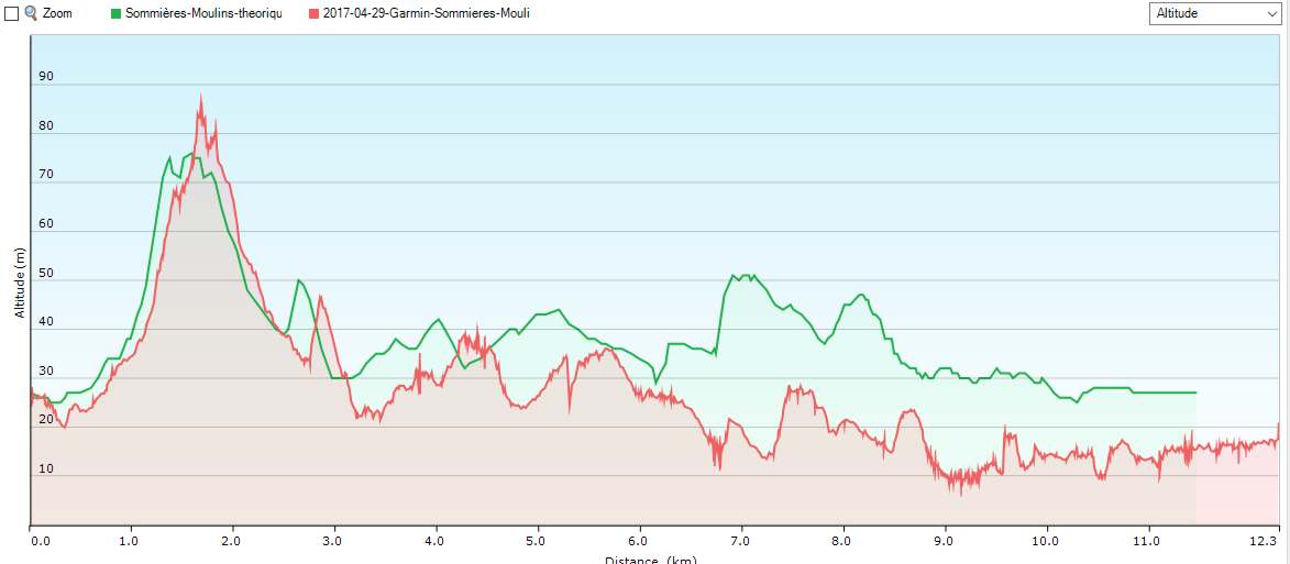
I used a Garmin GPS 64 to record altitudes during a recent hike along the the Vidourle river-mill circuit and compared the recordings to the theoretical altitudes obtained by generating the GPX with an online tool using the IGN basemaps. Here below is a comparison chart.

altitude comparisons

First, notice there is a growing lag between the peaks on the theoretical profile (green line) and the recording (red line) with the peaks on the recording occuring later then the peaks on the theoretical profile. This is normal, because we did not stick exactly to the theoretical track. At Montredon, we wandered around the site which added some distance to the recording that does not appear in the theoretical profile. (Note: We also climbed a bit higher than planned.)

However, there is still something strange going on. The recorded Garmin altitude, starting from around 3 km in, starts tracking progressively lower than the theoretical altitude. The Garmin data stabilises between 10 and 20 m altitude while in reality, no point on this circuit is below 20-25 m so the Garmin data is incorrect. Is this because the differences are within a margin of error for altitude measurements with a handheld device ? Maybe but if so, why is the tracking much closer for the first 3 km ?

WordPress mapping plugins

Orux Maps altimetric profile vs theoreticalThis site, built with WordPress, uses a couple plug-ins for mapping. They are Leaflet Map and WP-GPX-maps.

Leaflet Map

Leaflet map allows you to display a track on a map background. The plug-in allows for use of OSM maps via MapQuest. To use MapQuest you need to sign up for an API key from their website, and for modest use like this website, the API key should be free. However, I opted not to use Mapquest. This is France and France has the IGN (Institut National de l’Information Géographique et Forestière). This institute publishes folding paper maps at many scales and the 1:25000 scale maps are outstanding for hikers. It seems that every department in the country has a hiking trail plan and these trails are all marked on the IGN maps. One point of warning though. The paper versions are sometimes out of date. Continue reading “WordPress mapping plugins”

GPS trackers and altitude

All hikes start from the iron cross of Gattigues
Any attempt to get a good fix on cumulative climbing using GPS devices (handhelds, or smartphones) is fraught with error. Anyone who has used these GPS tracking devices knows that, while longitude and latitude are quite accurate, the altitude measurements at any given point vary from accurate to completely off the mark. GPS chip quality, embedded software and various external factors affect these readings. Walking at the base of a steep limestone cliff will cut out half of the sky and half of the satellite readings. Walking through a wet forest under wet leafy trees degrades the signals too. And there might be times when military services move the geopositioned satellites to serve a military purpose thereby degrading consumer level accuracy. So in this article, I compare a couple different apps to the Garmin GPSMap 64s to see if there are any conclusions. Continue reading “GPS trackers and altitude”

Privacy Overview

This website uses cookies so that we can provide you with the best user experience possible. Cookie information is stored in your browser and performs functions such as recognising you when you return to our website and helping our team to understand which sections of the website you find most interesting and useful.

You can adjust cookie settings by navigating the tabs on the left hand side.