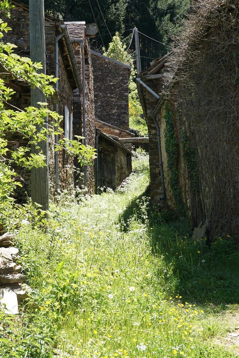
The upper Dourbie river

Hiking distance : 16.5 km ; Hiking time : 05:00
Tayrac

The Dourbie river starts on the Lingas, a mountain region just south of Mount Aigoual and flows generally east to join the Tarn in the town of Millau. Along the varied river course, the Dourbie flows through green mountain valleys and deep limestone canyons. This hike sticks to the mountain valley and starts in St-Jean-du-Bruel, runs up the right bank of the Dourbie, crossing near Tayrac and returning to St-Jean on the left bank. In the springtime, this is a very picturesque circuit in an even more picturesque region. This time we don’t visit the canyons which are further downstream. Continue reading “The upper Dourbie river”

The tower of Brison

Hiking distance : 17.7 km ; Hiking time : 05:30
the tower of Brison

In september of 2016, our club hike took us to the upper Beaume river valley and the mountain village of Laboule. We stayed in the area 2 days to hike a couple circuits on the Tanargue. The Tanargue is both a peak and a ridge-line oriented roughly west to east in the southern Ardèche – about 2 hours from the croix-de-Gattigues. The average altitude of this ridge-line is around 1200 m, but one section, called the Cham de Cros reaches an altitude of around 1400 m. This “Cham” (cham is an old french word usually used to name a small plateau surrounded by deep ravines) is visible from a long way off. From a variety of lookouts near the croix-de-Gattigues the distinctive skyline of this plateau is easy to identify. When we reached the top of the Cham, we could see, to the south, a prominent but lower peak with a tower and a beacon. No one could identify the site that day. So we had to find out. Continue reading “The tower of Brison”

Les Fumades

Hiking distance : 10.9 km ; Hiking time : 03:30
feeder
livestock feeder

This hike loops around several hamlets in the municipality of Allègre-les-Fumades. Les Fumades was a popular spa in the 19th century, drawing visitors from as far away as the UK and Germany due to the reputation of it’s mineral waters. Wartime (especially the 1914-1918 world war) and economic changes have taken their toll and, although still a spa, the town is not as popular as it once was. Apart from the spa, the town retains several points of historical and photographical interest. Continue reading “Les Fumades”

Rivermills on the Vidourle

Hiking distance : 12.3 km ; Hiking time : 04:00
weir at Villevieille river-mill

In these parts, almost everyone has heard of the river Vidourle. It’s famous for flash floods and devastation. But the river is a lot more interesting than just the flood damage it causes. For starters, it rises in a steep valley on the south face of the Cévennes mountain range where it collects water from many streams and occasionally from violent thunderstorm downpours. Flowing out of the valley at St-Hippolyte-du-Fort, it enters a karstic plain and promptly disappears underground. There is an “above ground” river bed which runs the 10 odd km between St-Hippolyte and Sauve and is often dry. In the small town of Sauve a substantial stream emerges from the base of the Coutach hills – this is the so-called “fountain” of Sauve – and flows straight into the Vidourle riverbed. This fountain presumably restitutes the lost Vidourle waters, and a lot more, to the main above ground riverbed. Then the Vidourle meanders on to Quissac and Sommieres. Later on, closer to the sea, the river flows into the Camargue marshes and has many possible courses. But that’s another story. This hike concerns the Vidourle river from the Runel river-mill north of Salinelles to Sommières. We start in Sommières and visit a number of interesting spots. Continue reading “Rivermills on the Vidourle”

Privacy Overview

This website uses cookies so that we can provide you with the best user experience possible. Cookie information is stored in your browser and performs functions such as recognising you when you return to our website and helping our team to understand which sections of the website you find most interesting and useful.

You can adjust cookie settings by navigating the tabs on the left hand side.